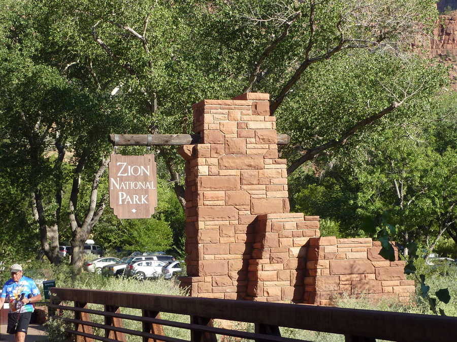
We left our car at the Desert Pearl Inn in Springdale and caught the town shuttle to the visitor center. From there we took the park shuttle bus which makes numerous stops along the way.
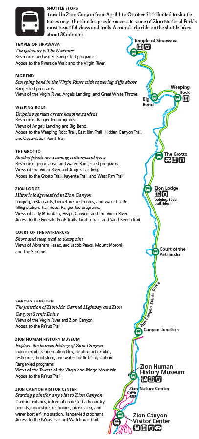
The bus traveling north along the Zion Canyon Scenic Drive provides access to countless trails. The park welcomes 3 million visitors a year but from spring through fall vehicles are prohibited.
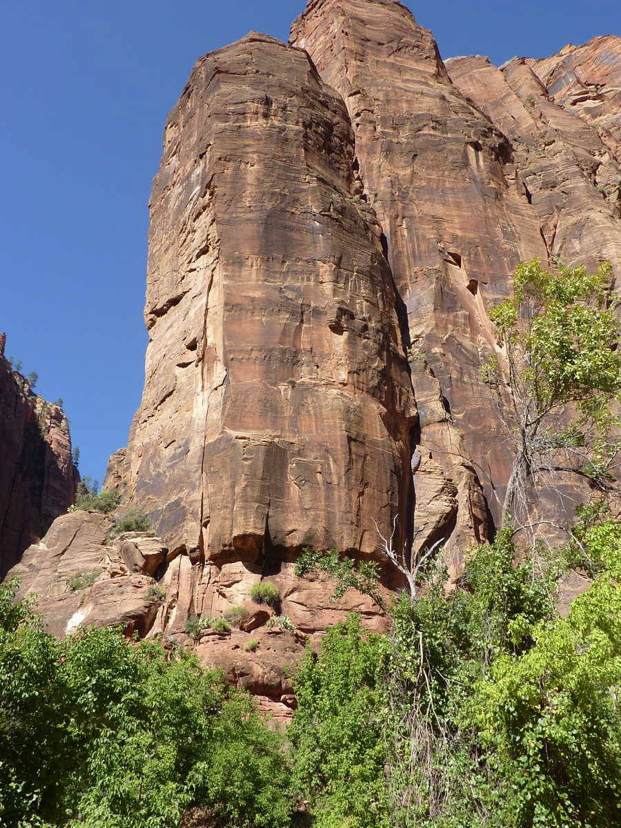
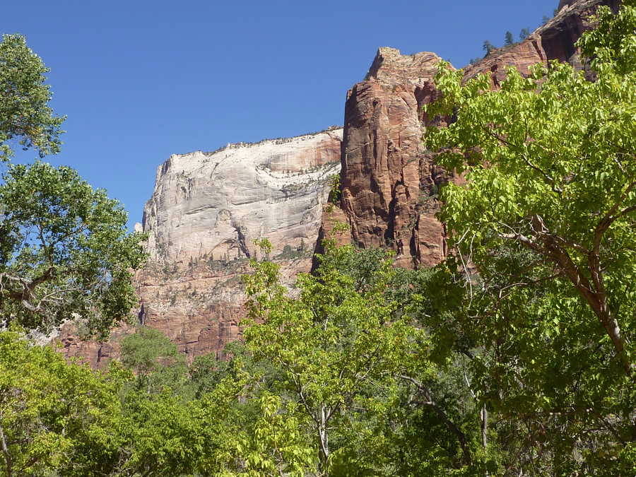
We attempted a hike to Emerald Pools Trail, but with with the air temp at 98F and the 7,000 foot elevation, we turned around after a short distance.
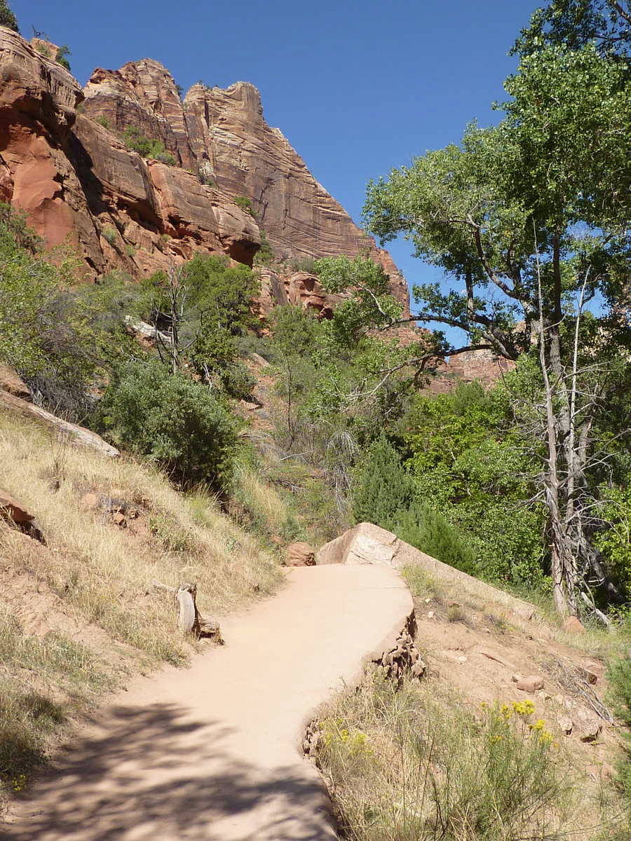
Continuing in the shuttle, we enjoyed getting out at several more stops and taking short walks to get a better look.
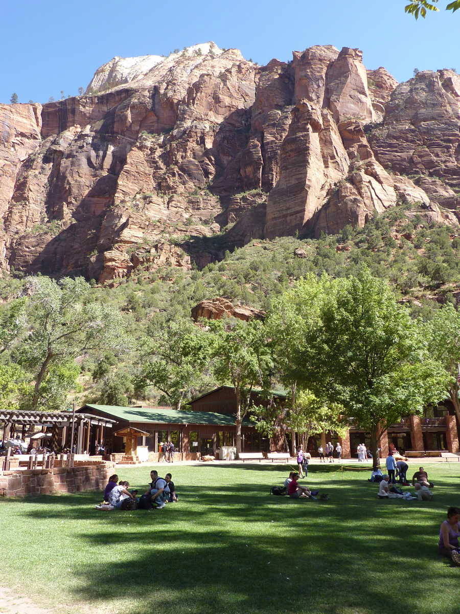
We enjoyed iced tea at the historic Zion Lodge. Built in the early 1900’s this lodge was part of the Union Pacific Railroads attempt at developing tourism. On our way back down we stopped at the Human History Museum.
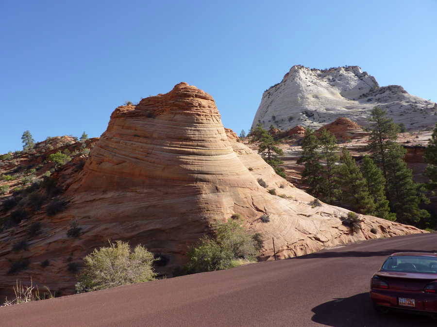
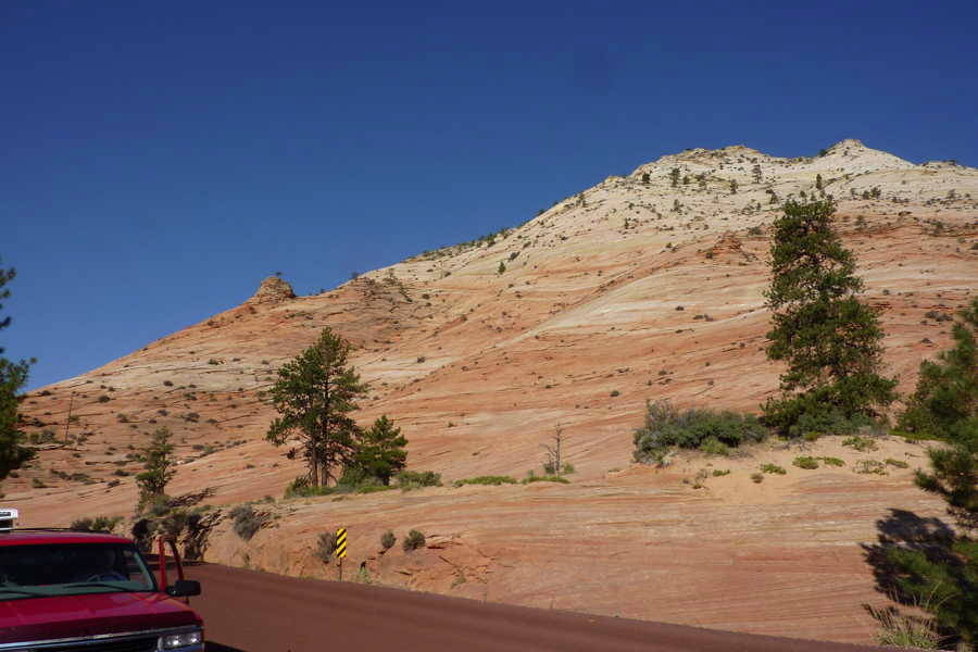
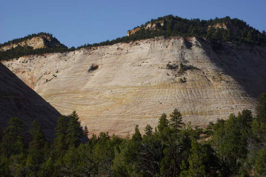
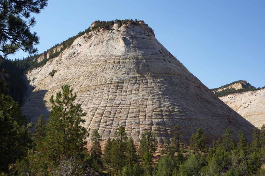
The next day we traveled the very scenic 25 mile Zion-Mount Carmel Highway, and its 1.1 mile tunnel. Referred to as the “Million Dollar Highway”, it was an engineering feat in 1930 and the longest tunnel of its type in the US. Today it’s listed on the National Register of Historic Places.
------------ Bryce Canyon National Park - Sep 30 ------------
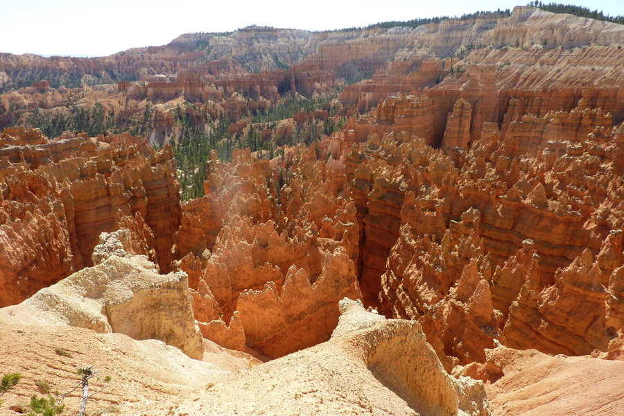
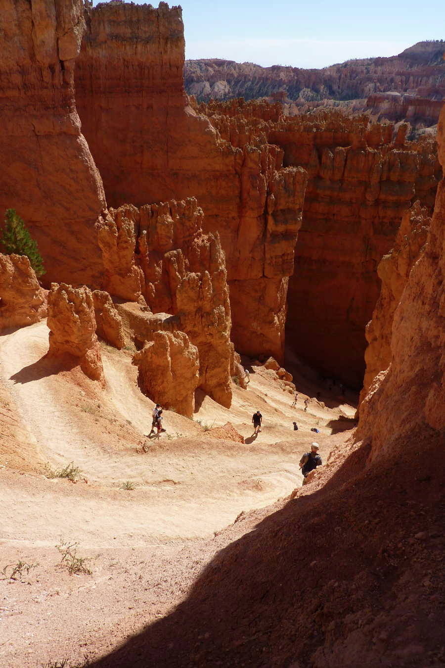
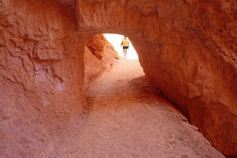
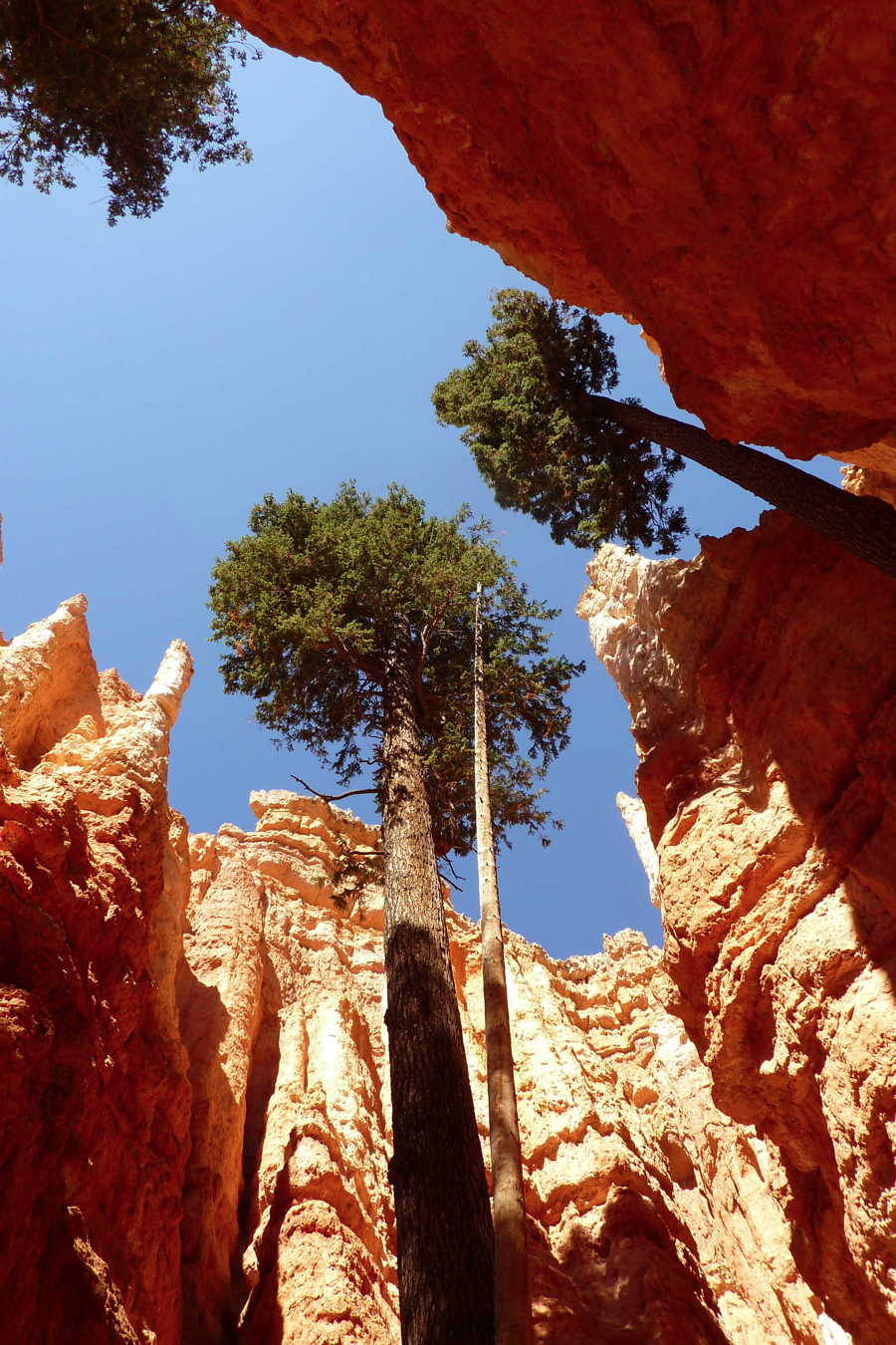
We started down the Navajo Loop Trail at Sunset Point, where Annamarie waited part way down and Al continued on to the bottom. This section is named Wall Street.
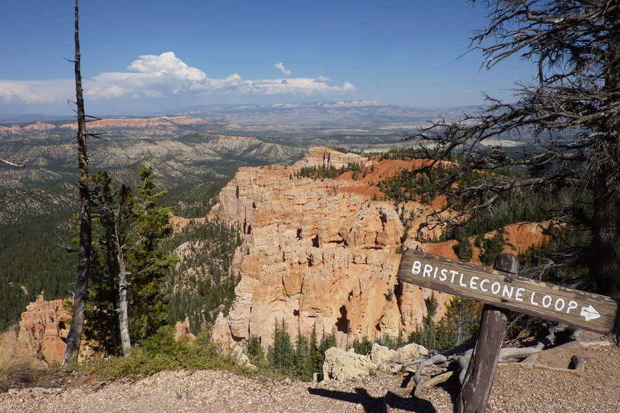
We walked this one mile loop at Rainbow Point and with just a 200 foot elevation gain we had some magnificent open vistas. The elevation at this section of the park is 9,000 feet.
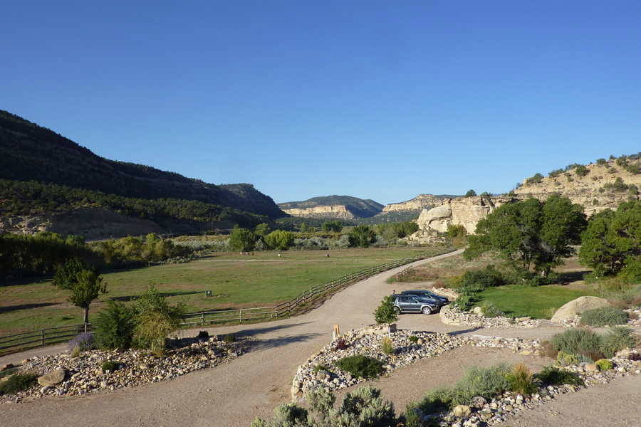
Views from the Slot Canyon Inn outside of Escalante, Utah. With a population of 900 people, it’s the largest town for 70 miles. Joette Marie, made a delicious breakfast of homemade granola and yogurt, with a side of fresh fruit. An egg puff and date muffins completed the meal. They raise most of their own food. Dinner was here at the inn, a wood fire restaurant called The North Creek Grill, and it was served outdoors under the stars.
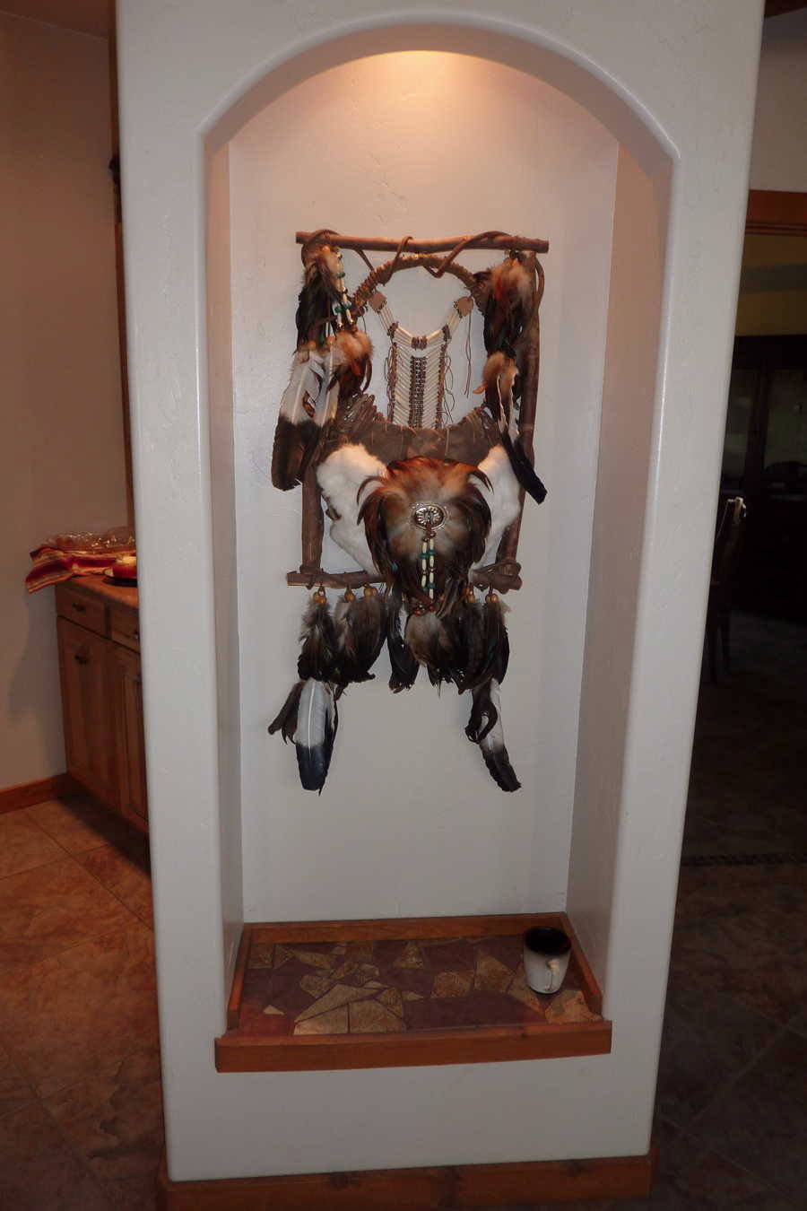
The Inn also had a very comfortable living room complete with excellent selections of books and art works from the area.
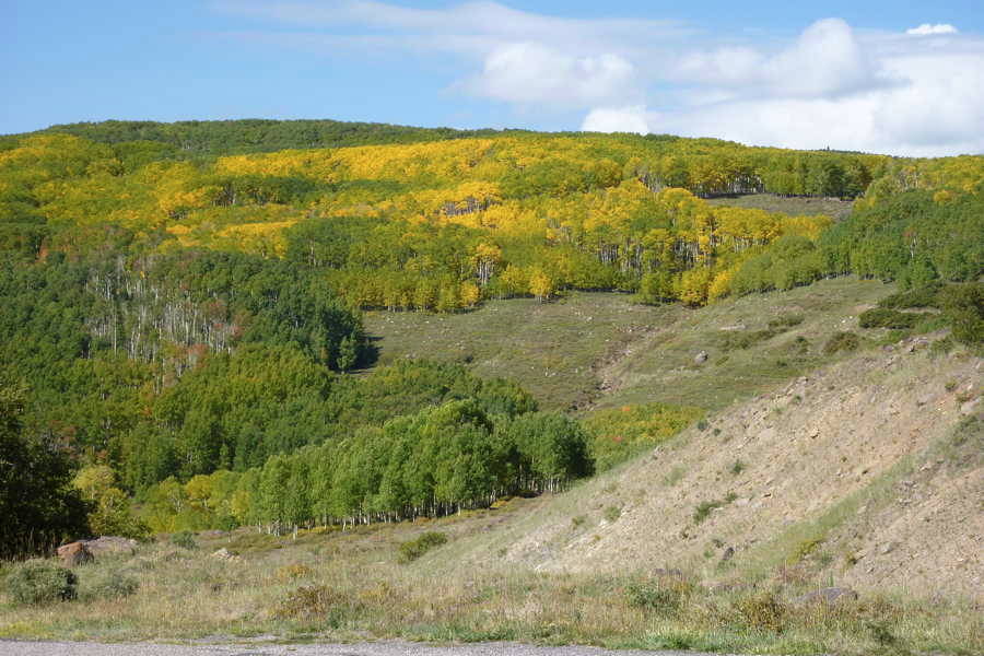
The aspens were showing color along Utah’s Scenic ByWay Route 12.
We stopped to visit the Anasazi State Park Museum in Boulder which containes an extensive collection of Ancestral Puebloan pottery and other ceramic objects. The property contains the preserved remains of an ancient village which were interesting to see and walk around.
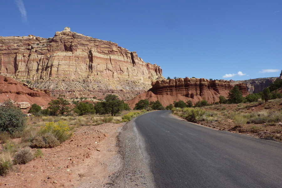
------------ Capitol Reef National Park - Oct 1 ------------
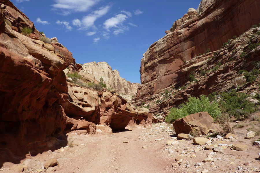
We hiked part way down this wash trail but the elevation, heat and threatening thunderstorm discouraged us from continuing to the end.
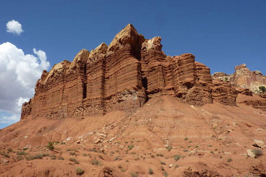
This formation is named "Egyptian Temple."
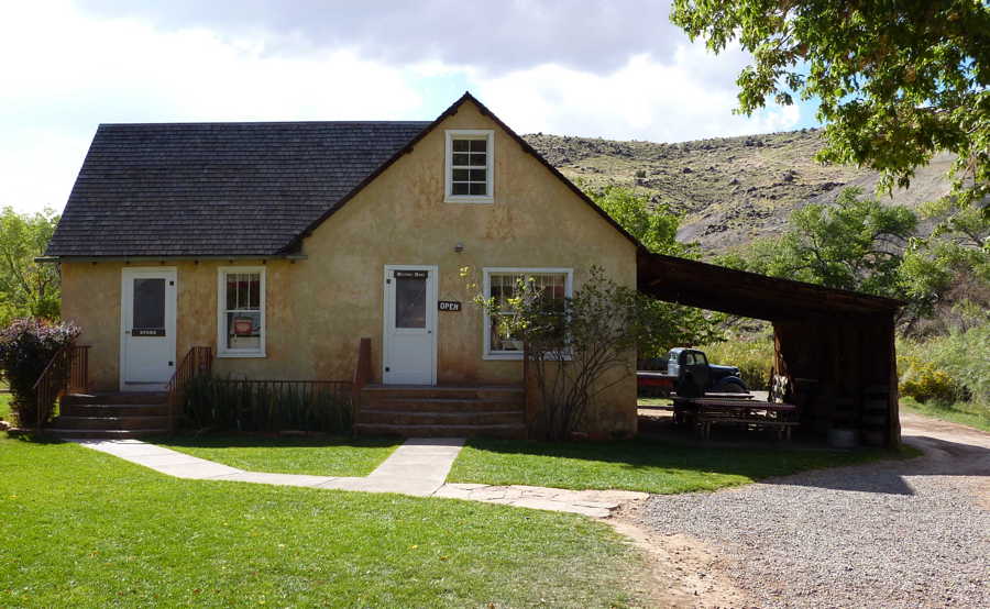
The Gifford Homestead, in the Fruita valley, interprets the early Mormon settlement and serves as a small museum and gift shop. This national park has two unique features, the nearby orchards are protected as a Rural Historic Landscape but visitors may pick fruit. And at 8 AM each morning a bakery in Torrey provides campers with freshly baked homemade pies ! We purchased homemade peach ice cream here after our picnic lunch across the road.
-------- Canyonlands National Park, Islands in the Sky - Oct 2 -------
Our first walk was a mile to Upheaval Dome, a very intriguing rock formation of unknown origin. Two different theories are presented on these placards.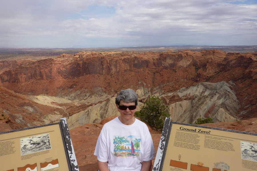
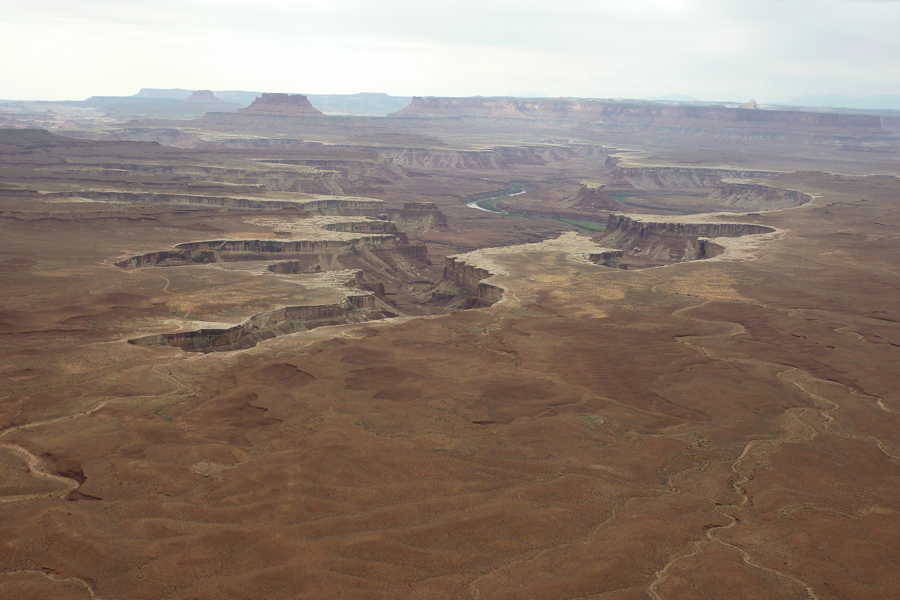
A view of the Green River was our next stop. Its intersection with the Colorado River separates the park into three ares: Islands in the Sky, Needles and the remote Maze section.
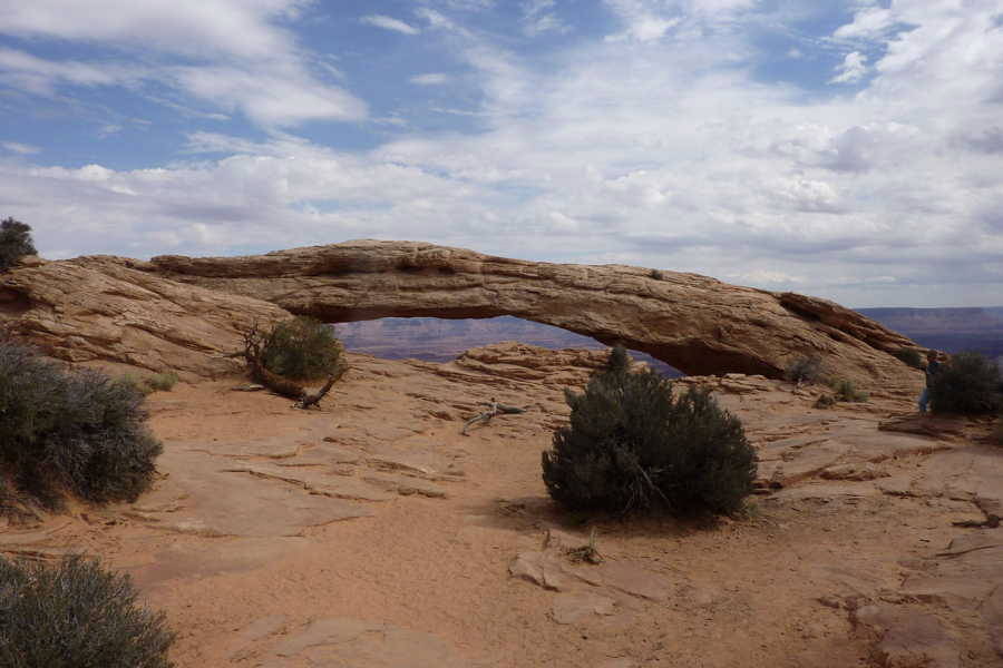
A short half mile hike took us to Mesa Arch, perched right on a cliff edge.
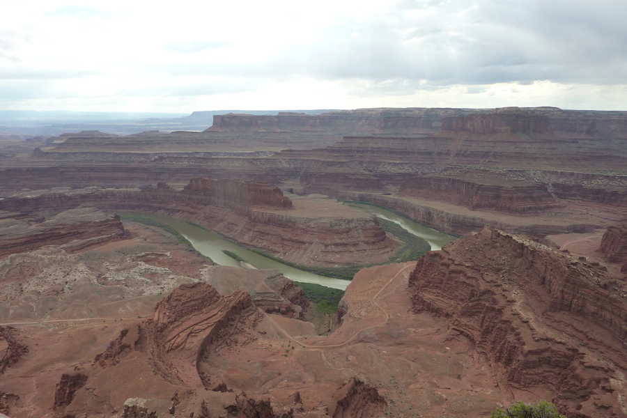
Dead Horse Point State Park, nine miles north of Moab, towers 2,000 feet above the Colorado River and is sometimes referred to as Utah's Grand Canyon. It offers breath taking views of the southeastern canyon country and Canyonlands National Park. Legend says that in 1800's cowboys used this point to capture horses, choosing the ones they wanted to keep while others were left corralled on the waterless point.
------------ Hovenweep National Monument - Oct 3 ------------
On our way to Hovenweep, we took an easterly route to see the Anasazi Heritage Center, which is the visitor center for Canyons ofAncients National Monument.
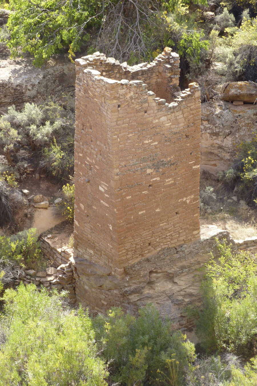
Hovenweep, a Ute/Paiute word that means “deserted valley” contains six groups of ancestral Puebloan ruins that date from 1230 to 1275. The Square Tower ruin has 20 foot high walls and this was one of the many ruins we saw on the 2 mile Rim Trail Loop. A checkdam provided irrigation water for their food crops. Some structures were used to store grains for the 100-150 inhabitants.
------------ Canyonlands National Park, Needles - Oct 4 ------------
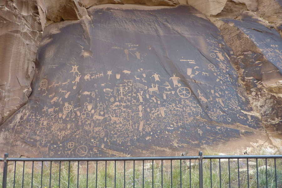
We stopped to see Newspaper Rock, which was along our route.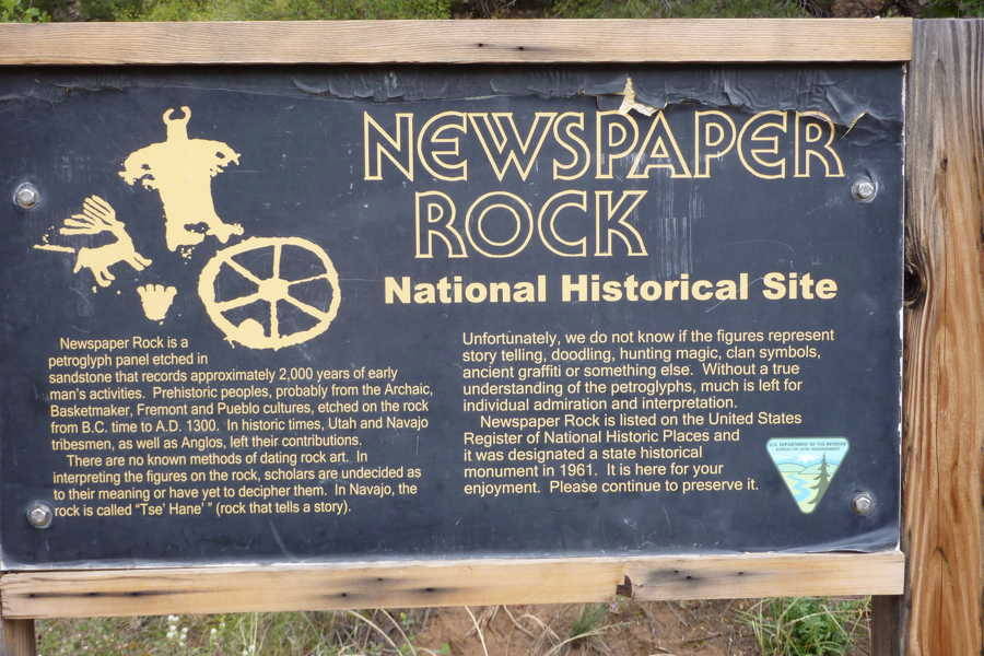
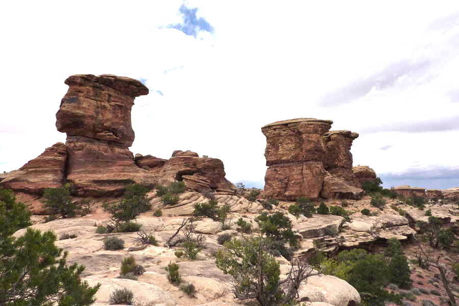
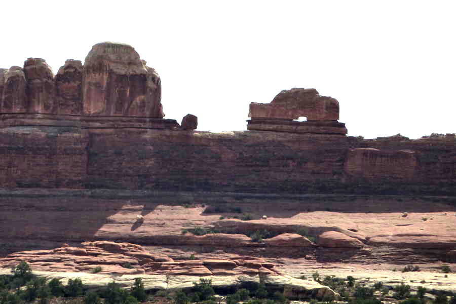
The park ranger helped us plan our sightseeing tour. This photo is a good example of the interesting shapes and colors that we encountered on the scenic drive.
Wooden Shoe Arch is easy to spot.
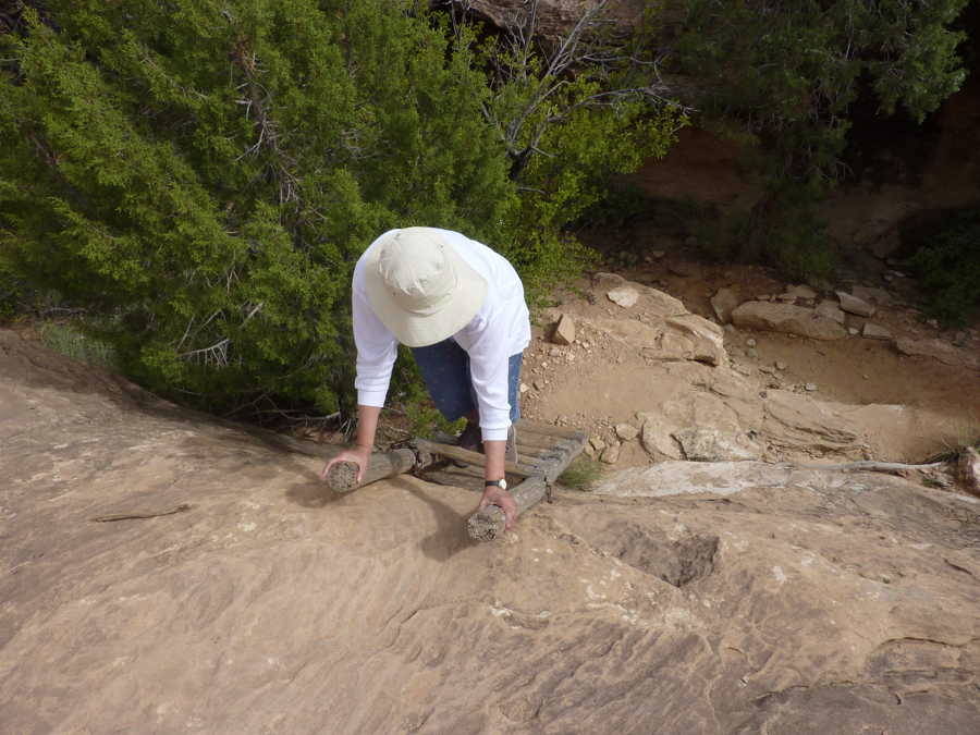
The .6 mile Caves Spring Trail Loop took us up several ladders, but it was well worth the effort. The trail led to the historic cowboy camp and prehistoric petrographs..
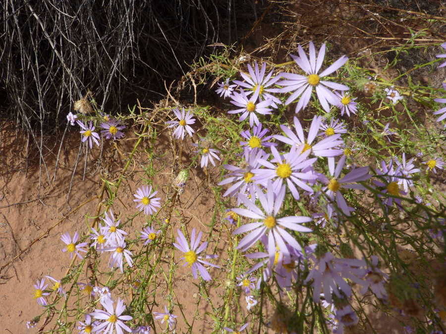
These flowers marked the beginning of our walk.
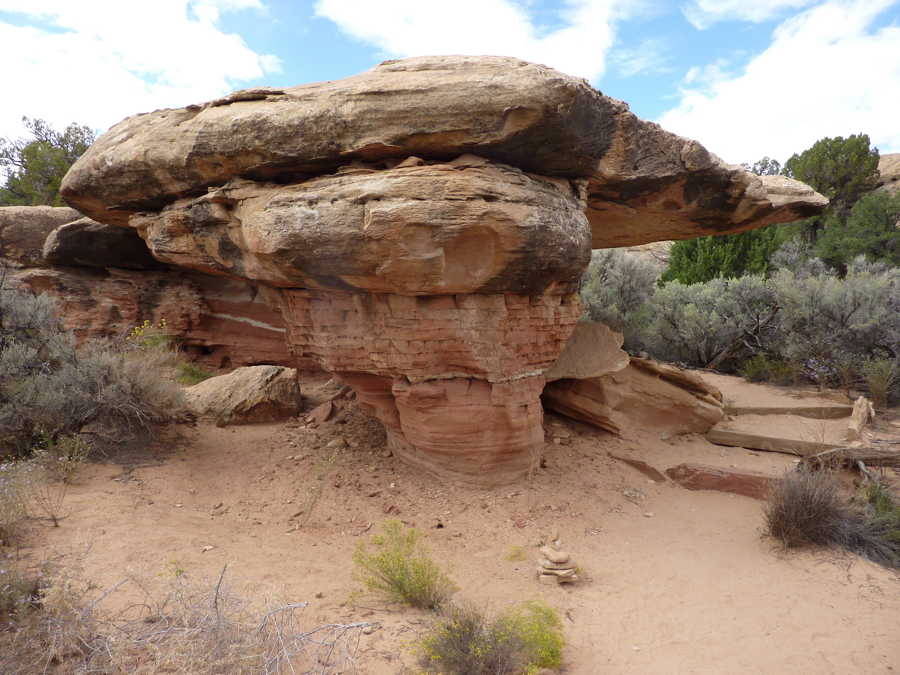
This is a good example of a mushroom.
The Edge of Cedars State Park Museum, an ancient archaeological site and research center, in Blanding was one of the highlights of our trip. It houses thousands of artifacts of the ancestors of contemporary Puebloan Peoples that date back to 825 AD.
------------ Arches National Park - Oct 5 ------------
Balanced Rock was on our "must see" list and it was our first stop. It was visible from a long distance and there was ample parking near by.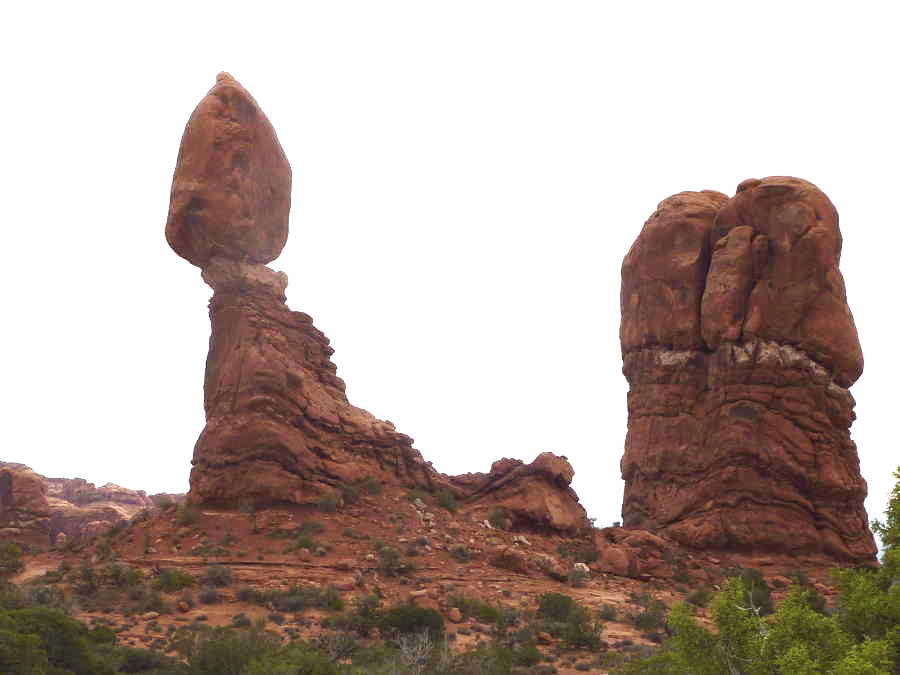
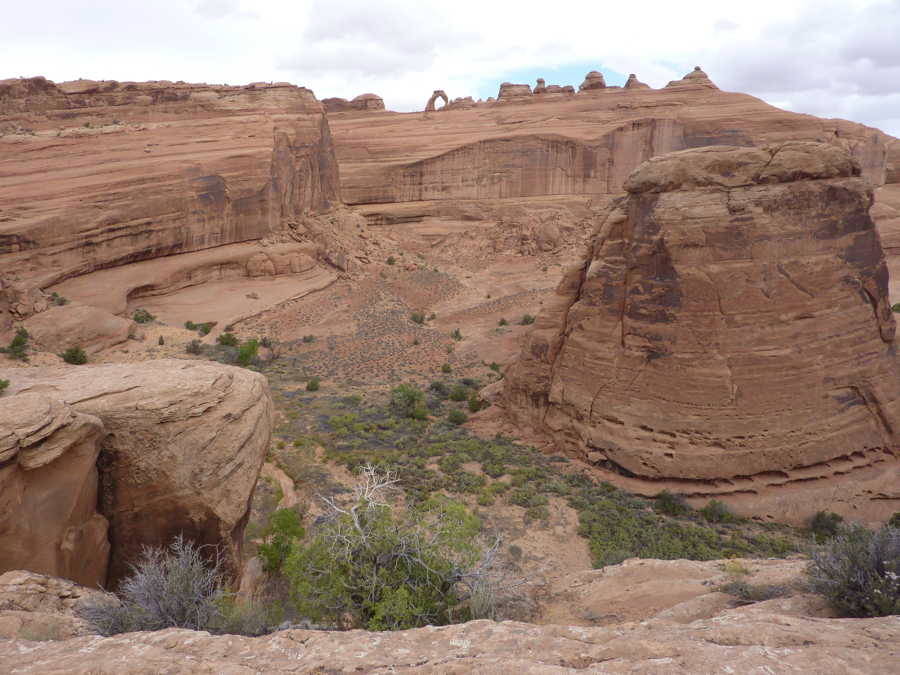
Delicate Arch was our next stop but seeing it involved some hiking, even to see it from this distance. It can be seen here in the center of the horizon.
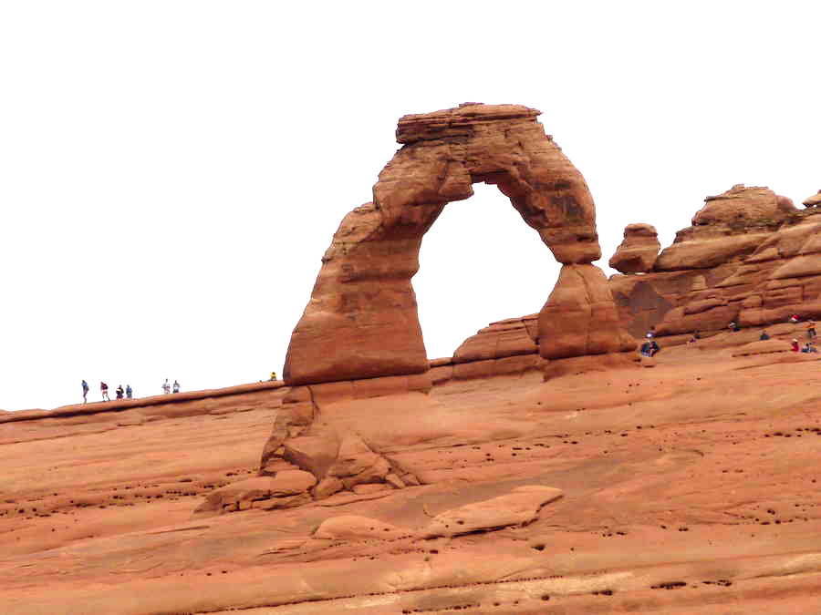
Standing in the same spot as the previous photo, our telephoto lens brought it much closer. There is a separate, much longer trail that leads right up to the arch.
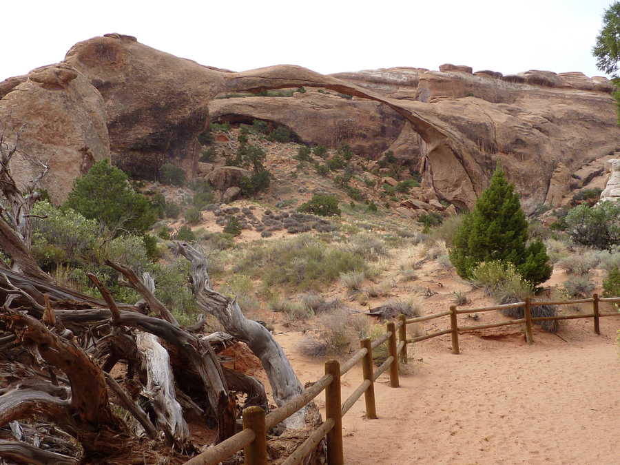
Our hike in to see the 306 foot span, Landscape Arch, was on a very windy, chilly day. This natural rock opening competes with Kolob Arch at Zion for the largest geological span in the world. In 1991, a 60 foot long, 11 foot wide, and 4 foot thick slab fell from the underside. At that time the park service closed the trail that continues under the arch.
------------ Zion National Park, Kolob Canyon - Oct 6 ------------
The Kolob section of Zion is the northwest entrance to the park and has very few visitors.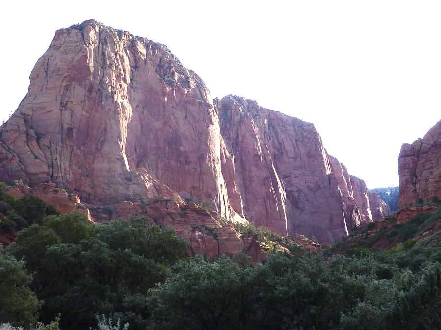
If you want to see more of these photos, all from this trip are in our Dropbox.