Hot Springs Cove to Kingston, WA
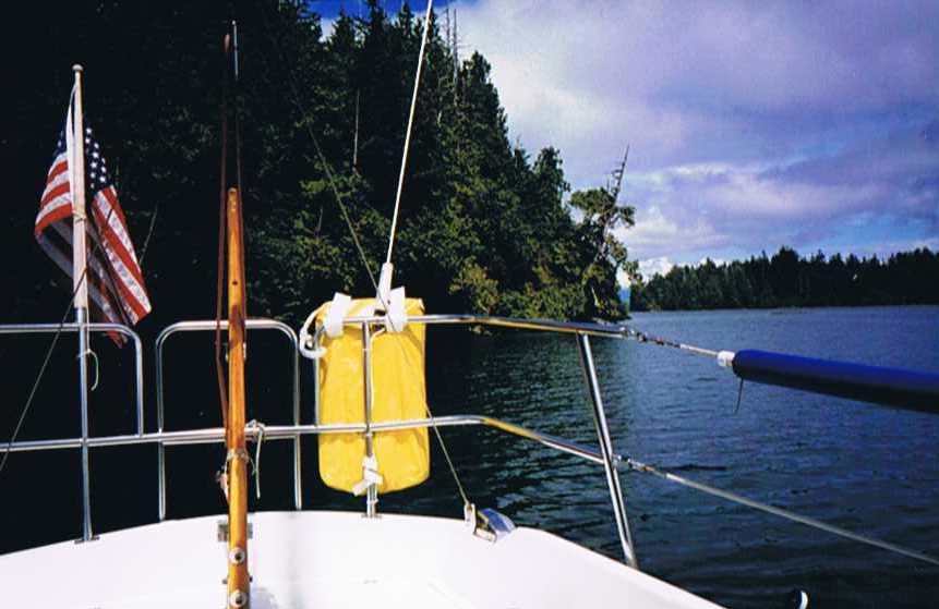
Monday, June 14 - I left at 7:20, said a final goodby to John and Barbara who were on their way to the boardwalk, and I was off to catch the slack at Hayden Passage. I bucked the ebb all the way up Sinclair Inlet. I was thinking how stupid this all was as I would be running against the flood once in Hayden Passage as it runs up to 4 knots. Then I remembered that it floods south, so I made quick progress once I rounded the corner and arrived in Matilda Inlet much earlier than what I expected. I had been waving to the locals but tried some really enthusiastic waves and I got enthusiastic waves back. One boat seemed not to respond at first then I heard a horn, not unlike a train whistle and turned to see about 4 people all happily waving back to me as they sped past. I wove my way into Matilda Inlet, set the anchor and rowed ashore.
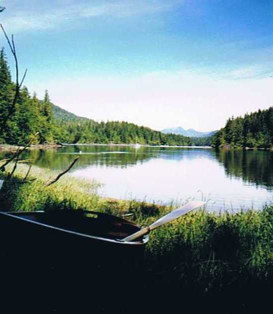
I took the GPS with me this trip to the shore. I was curious about its use in following trails. It wasn't very effective for that as it turned out but I was able to clock my speed rowing Isabella at 2.7 knots and the distance from the beach to Corleto came out at about a mile.
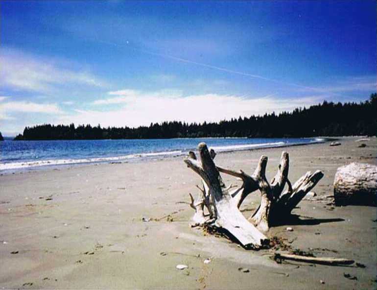
I never found the sulfur works pool, but Whitesand Beach was quite worth the effort. This is all part of Gibson Provincial Marine Park. The trail head, it turned out was completely unmarked and I spent some time finding it. I talked to some kayakers who were rounding Flores Island and had pitched their tent on the outer beach. We discussed the bear and cougar tracks, which I'm sure they were not happy about. I had about 4 mosquitos in the cabin when I buttoned up for the night. I had not had any bites but I didn't want any so I went to sleep with my head covered and only a small hole to breathe through. I awoke at 3 am and could still hear the mosquitos buzzing around, but I was too warm to stay covered so I thought I could slap them if they got near my ears. In the morning I determined that these mosquitos weren't interested in feeding as I had no bites after sharing the cabin with them all night.
17.5 miles - 4 hours - no rain
Tuesday, June 15 - I left at 5:40 am in order to catch the slack at Tofino. This gave me all favorable tides except Calmus Passage where I bucked a 3 knot ebb current in heavy fog.
I was grateful for the GPS and for having worked out all my bearings and distances the night before when I found my drift angle was near 45 degrees when rounding a shoal at the south end of the passage. I arrived at the fuel dock right at slack. I used a little over 10 gallons of diesel since Alert Bay. I had expected to have used far less for the entire trip home. I bought ice, got a shower, called Annamarie, got groceries, post cards, stamps and wrote and mailed the cards. I then had the best tasting hamburger with Swiss cheese, bacon and mushrooms, that I have ever tasted. After touring all the galleries I went back to the boat and took a nap.
I was awakened by the rattling scream of a transmission in reverse and then a big slam and bang into the dock. I jumped up in my bare feet and started throwing my drop boards onto the cockpit sole, making as much noise as I could. "What's the deal?" I asked a tough as nails looking fisherman who looked like he had spent a miserable day out on the rolly seas. He says: "If you'd read the sign out at the end of the dock, it says commercial boats only." I say: "Yeah, there are signs like that on the other docks but not this one, that's why I picked it and the harbor manager didn't say anything when I told him where I was docked." He: "I've got all my stuff spread out along the dock, this is where I always tie up." I: "Okay, I'll move to another spot then". He: "I'm here and I'm not moving." I: "If you tie to my cleats and it gets bouncy tonight you'll jerk them right out of my deck." He: "I'm tyin' to the dock." (I realized at this point he was intending to use my little 3 ton sailboat as a fender for his 40 ton fishing boat.) I: "I'm leaving real early tomorrow morning". For the first time, I get no response, and I know I've got him on this one. "I'll just take a minute to get out of here" I say, after a slight pause, and proceed to untie. By the time I got the engine started and untied he had untied and was backing out. I turned and drove out frontwards, still in my bare feet in the rain without my glasses. After tying up in the unloading zone I found the manager was long gone, so I moved to his reserved spot. Did I have a word for him if he showed up. After all that, I went back and apologized to the crabber for taking his spot, and he apologized for loosing his temper at me. He was quite interested that I was going around the island alone and wished me a good continuation of my trip.
Dinner at the same place where I had lunch was terrible that evening. The "Halibut Bawden Bay," which was highly recommended by the lunch time waitress, was over cooked, the shrimp stuffing was tasteless, and the sauce had way too much pepper in it. The wine, bread, salad, and dessert were all good but the taste of the burned fish and pepper was too much. Tofino can be a party town and there are many live aboards at the marina. Lots of comings and goings. Lots of the younger crowd, which apparently like the beaches for the surfing.
16 miles - 3.5 hours - heavy rain
Wednesday, June 16 - I left in the fog at 5:30. I put up the mainsail but still needed the engine to keep Corleto moving. I could see 10 to 15 fishing boats at any given time between Tofino and the Swiftsure Bank, off Cape Beale. The adverse current persisted and my 5+ knots water speed was cut to a 3.5 knot average between Lennard Island and Humphries Reef in Barkley Sound.
I felt a bit of apprehension threading my way between all the reefs and submerged rocks and spent quite a lot of time comparing bearings to all the visible points and the chart. These rocks all look pretty much the same and it's quite easy to mistake one for another. At this point, I have no faith at all in the GPS. If there had been fog, I would have taken a longer route and gone around to where there was a wider opening.
Behind me, as if on cue, I could see the pilothouse as they slipped through Carolina Channel. At first I thought they were headed for Ucluelet, but then they nearly caught up to me as I rounded Dodd Island and slipped into Turtle Cove, or "Joe's Bay," as Douglass calls it. The pilothouse continued on, probably to Jaques Island or to the Pinkerton Islands, or to half a dozen other equally fine spots in that direction.
For the first time in six anchorages in Barkley Sound, I shared an anchorage with another sailboat. We were about a mile apart. About 15 different kayaks came through the cove during that evening, but I never saw where they had camped.
38 miles - 8.5 hours - heavy rain
Thursday, June 17 - The 4 am weather forecast for the Strait was for westerly winds building to 30 knots with an "outlook" (following 24 hours) of light winds. So, at 5 am I got underway toward Neah Bay.
The plan was that if it was foggy, I'd change course and go to Port Renfrew, so I wouldn't have to cross the traffic lanes, or possibly go all the way to Becher Bay if I caught a really good westerly wind early enough. Same for going to Port Angeles if it was clear and I got good wind. As it turned out it was clear but no wind, so I had to motor all the way to Neah Bay. Several pods of porpoises came to greet me as if on cue once again. I'm not sure why, but it always gives me a thrill when they do that.
A straight line between Cape Beale and Neah Bay runs diagonally through the "no mans land" in the traffic separation scheme and a sailboat can easily get in the way of commercial traffic. The tricky part is that the ships all make turns in this area, so they can be nearly on top of you before making their turn. This is one area where I had not really done my homework ahead or I would have angled around this spot, as it could have gotten pretty tense for me if several ships had arrived as I went through. The two hours that it took me to clear the area went quickly and only one ship passed through ahead of me. I crossed his wake 12 minutes behind him.
It was a cold day and glassy smooth water, so I fired up the galley stove several times while underway to make toast and soup. Hot food is a real treat at such times. I called Annamarie on the cell phone but the connection was poor so I called again later from a pay phone at Neah Bay. I checked into customs by phone, got a slip, more ice and had some fish and chips for dinner and a great chocolate chip cookie.
45 miles - 12 hours - rain
Friday, June 18 - The forecast was still the same, 30 knot westerlies changing to light and variable. Off at 5:25 am under dark cloudy skies amidst the fishing fleet, so it was quite rolly getting out past the buoy where I could make my turn east. No wind at all and a 1 to 2 knot adverse current, so I looked for back eddies along the shore. If I couldn't make better speed than yesterday, it would be 10 pm before I got into Port Angeles. There were submerged rocks inside the 10-meter depth curve so I set the shallow alarm for 12 meters and stayed between 10 and 15 meters, weaving my way along the shore.
Shore West of Piller Point, Strait of Juan de Fuca.
I seem to gain a knot this way, but it's certainly a lot more work and the alarm was sounding half the time, which wears away at one after a while. This course put me right in the riff line, where all the floating kelp, logs and other floating junk seems to collect, so I had to keep a constant watch.
My speed over the bottom was still coming out around 3.5 knots and it was 54 miles to Port Angeles, so it would be a long day. By noon the wind picked up and I was broad reaching with the engine off, but still only 3.5 knots over the bottom. Then the wind started building and it became a beam reach. The winds built to over 30 knots very quickly. Steering in surfing conditions is way beyond what the autopilot can handle so I was hand steering. Gusts tried to round Corleto up in a broach so it was a constant strain to keep her headed on course. The knotmeter was swinging between 6 and 8 knots until the waves started building into the opposing ebb current. I knew this would only last for an hour or so and the flood current would smooth out the waves. Also, I knew the wind wouldn't last so I kept up all the sail and hung on for the ride. And what a ride it was.
The swells built to over 8 feet in height and were stacked 20 yards between peaks. They weren't all that big but often Corleto's stern would rise on a wave while her bow pulpit would be nearly into the preceding wave. I would turn her to keep her surfing down the wave and we could often stay with a wave for nearly a minute. A glance at the knot meter when this would happen would find it pegged at 12 knots, as high as it goes. My GPS was showing speeds averaging up to 10 knots for much of this ride. It finally blew out and the flood kicked in as I knew it would, and I was able to get back on autopilot long enough to get to the head and grab some lunch, then I saw another dark cloud coming.
It was just like before only without the big waves. This time we flew along more slowly through the water, but that flood current kept us going over the bottom at nearly 8 knots. Port Angeles passed by to starboard a little after 4 pm and stopping there was no longer even a consideration. I was headed to Port Townsend! As I neared the Dungeness Spit Lighthouse, the wind calmed down enough for the autopilot to finally take over and I called Annamarie to see if she wanted to meet me in Port Townsend. She did. I estimated my arrival at Port Hudson at 9 pm and managed to hit it right on the minute. I sailed all the way to the entrance.
78 miles - 15.5 hours - rain
Saturday, June 19 - Annamarie drove me back to Port Townsend after a night at home, and I left at 3 pm to motor back to Kingston in very calm air. Strangely, I should have had some help from a flood current but I saw more ebb current for the whole trip except right through the Port Townsend Canal where the flood current was 2-3 knots.
24 miles - 5.2 hours
Totals
20 days
776 miles
183 hours underway
151 engine hours
12 rainy days
3 days of heavy mist
3 cloudy days
2 sunny days