--- Puget Sound to Hot Springs Cove and Return - April 1999 ---
The inspiration to make this trip came from John's wife, Barbara. John had spent many years building "Manali", their 29 foot Joel White designed sloop. He was anxious to go "see what she would do". I had suggested a shakedown cruise from Victoria out to the west side of Vancouver Island and back. Barbara wasn't quite ready for venturing that far and suggested that John and I go on this first trip and she would go the next time. So, John and I went. Barbara did go on John's next trip, which was all the way around Vancouver Island, only a month later.
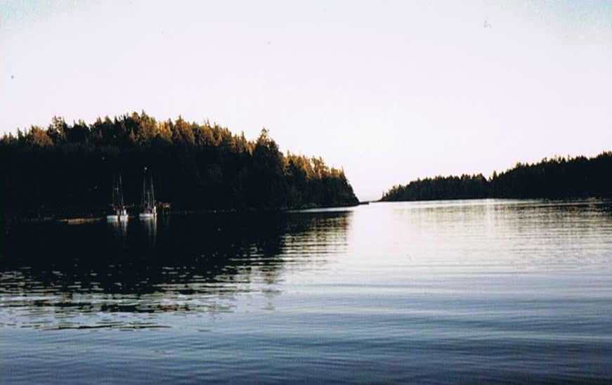
Hot Springs Cove is located about half way up the outside of Vancouver Island, BC. The main attraction is the hot, fresh water springs that flow right out of the rocks through pools, and into the sea. This area is the Maquinna Provincial Marine Park. A remarkable, one and a half mile long boardwalk has been constructed to the springs and there is a float which accommodates half a dozen boats, and five mooring buoys. Float planes and watercraft come from Tofino and other areas throughout the day.
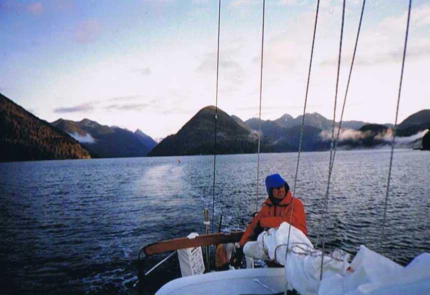
Monday, April 19 - I motored "Corleto", our Catalina 27, from Kingston up through Admiralty Inlet, past Point Wilson across the Strait of Juan de Fuca to near Beaumont Reef, off Discovery Island. A SE wind picked up and I sailed the rest of the way to Canoe Cove, just north of Sidney, BC. I had promised John a phone call at 2 P.M., so he could meet me. So, at the prescribed time, which found me in Haro Strait, I switched to autopilot and made my call. As it turned out, the AP got overwhelmed and quit for the day as it typically does if over worked. By this time the wind had picked up to 20+ knots and Corleto was surfing along at 6-7 knots with the working jib and full main and I needed to shorten sail. I hove to and reefed the main, and was back on my way. As I approached Iroquois Channel, I hove to once more to drop the jib and main. Corleto doesn't stay hove to with the jib down, so I waited while she rounded up a second time to drop the main. After motoring through Iroquois Channel, I found myself in a swift side current with rocks downstream. I wondered which would be quicker at this point if the engine suddenly failed? Get the sails up or drop the anchor? But, I locked the helm and was able to keep headed up current until I got out the mooring lines and fenders. John met me at the customs dock and I reported in by cell phone. We moved Corleto to John's slip, which would be her home for the next 12 days. We transferred all my gear and provisions to "Manali," John's 29 foot, Joel White designed, double ended sloop that he built himself.
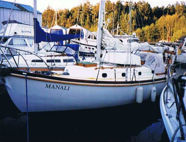
"Manali" is a striking boat, with her varnished bulwarks, coaming, rub rails and hand rails. All fittings are cast bronze, made from John's patterns. He designed and made patterns for the bow rollers, the stanchions, and even his own port lights, which he fitted with screens. It was all quite remarkable, even more so considering he was working full time during the nine years in which she was built. This trip was planned as a shake down cruise for both Manali and John as she was only recently launched and John was still new to West Coast sailing. We decided to both sleep on Manali so we would be ready for an early departure the next morning. John cooked and I did the dishes, which started the pattern for the next 12 days.
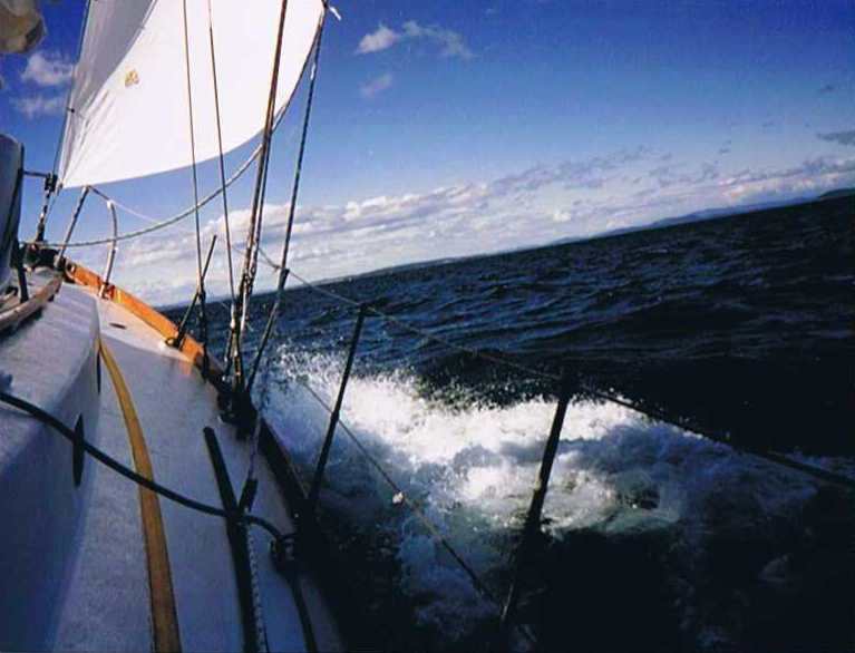
Tuesday, April 20 - The 5 A.M. weather predicted gale force winds in the Strait and the wind was howling in our rigging even in the slip, but we headed out anyway at 6 A.M. Sailing down between Trial and Discovery Islands, we had to pull a double reef in the main and switch from the working jib to the storm jib.
We found that Manali could not make way sailing close hauled with this rig, neither sail had quite enough power. I suggested motor-sailing to get us through the tight parts and this saw us through to Victoria. Arriving in Victoria, I discovered my sleeping bag and pillow soaked in seawater. The engines exhaust anti-siphon valve, which was located in my quarter berth, had stuck open. Fortunately the sun was out and it was very windy so I got them dried out before sundown. John called Barbara, who showed up shortly after with the #3 jib, which was larger the storm jib. We knew we need a sail between the size of the working jib and the storm jib if we were ever going to be able to sail upwind in over 20 knots.
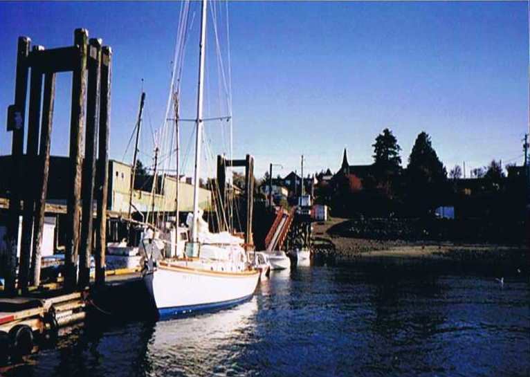
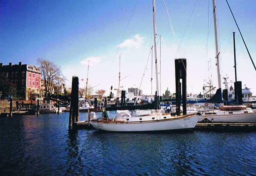 Manali in Victoria.
I made my way to Munroe's Bookstore and bought the new edition of Guzzwell's "Trekka Round the World" while John repaired the valve and Barbara went to her rowing class. John cooked stir fry and Barbara and "Juno," their instantly lovable bull terrier, joined us for dinner.
Wednesday, April 21 - While we motored out of Victoria at 6 A.M., I called Annamarie on the cell phone and reached before she left for work. Race Passage was calm as we passed through on the morning's ebb, and we motored on, arriving at Port San Juan at 15:45, where we anchored between the Port Renfrew pier and the breakwater.
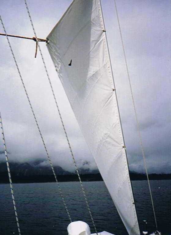
It became windy, so John rigged the storm sail on the aft stay as a riding sail, which kept us pointed nicely into the wind and the swell that makes it's way into the harbor.
John's Riding Sail:
Thursday, April 22 - Manali's 35 lb CQR anchor managed to drag when we were picking it up and it came up fouled with pieces of wood and a rope. Fortunately, winds had been light overnight, or we might have ended up in the nearby shoal. John determined that the reason was that I had not backed down sufficiently when we had anchored the afternoon before.
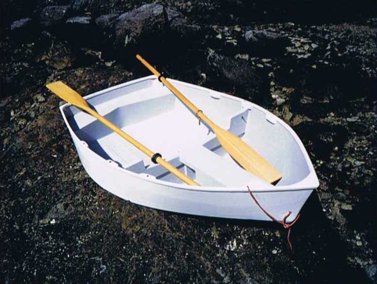
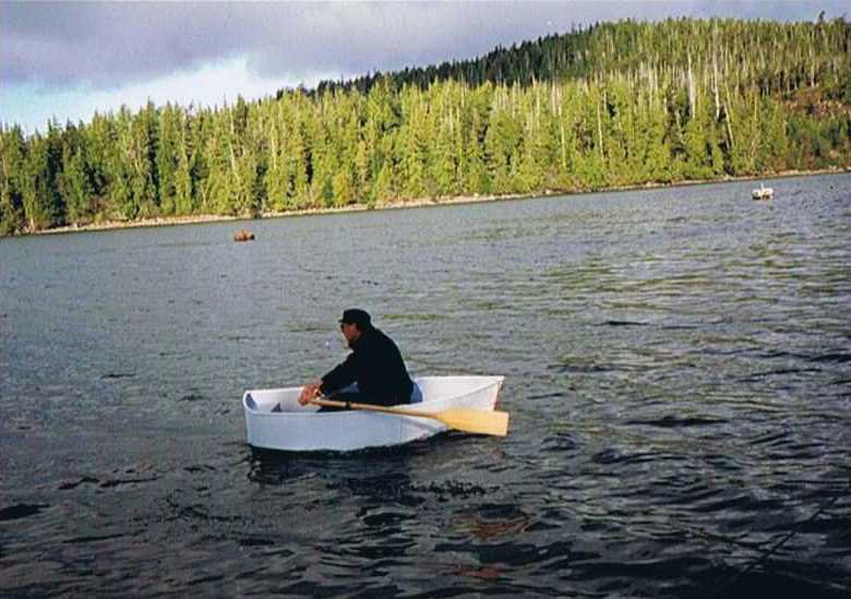
Motored to Effingham Is. where we anchored (This time backing down at near full throttle.) and tried out John's nesting dinghy, which he designed and built. It is constructed of 1/8" door skins and fits under the boom forward of the dodger. It performed beautifully and weighs only 60 lbs. despite the added weight from the flotation built into both sections.
John's Nesting Dinghy.
Using the dinghy, we rigged a stern line to shore, as the anchorage is quite confined, and with limited swing room. Ashore, I showed John the huge Spruce trees, which are not obvious from the water. Although we had seen large clumps of mussels on the way in, we were only able to find one here, most likely because of the popularity of this anchorage.
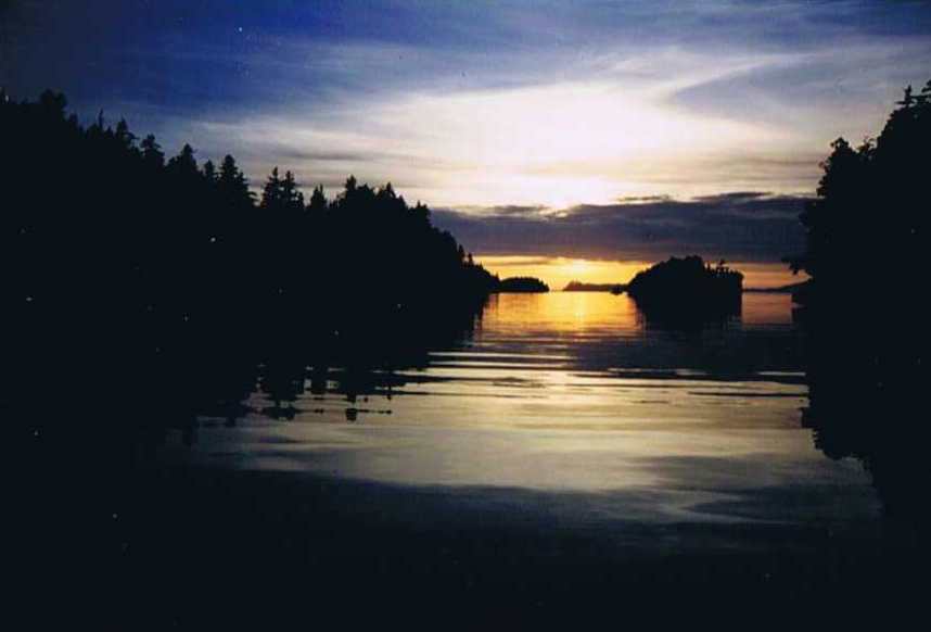
We enjoyed a beautiful sunset.
We motored out between Benson and Clarke Islands beyond Mara rock and set sail. The wind was NW so we were close hauled and John set the #3 jib with a single reef in the main.
The #3 was an untried, used sail which quickly proved useless as it had little shape and we had to motor sail to make any headway northward. We continued, adding a second reef to the mainsail as the winds were now over 20 knots. The swells picked up to the point where it required falling off to avoid slamming into deep troughs which would suddenly present themselves.
I was amazed that Manali, despite her 10,000 lbs. and full keel with old-fashioned rudder attached to the keel, was very responsive to the helm when her speed was kept over five knots. This allowed falling off the really large waves without slamming or loosing speed.
Without the engine, however, we could make no progress at all to windward and could only maintain steerage by falling off to a beam reach. We also tried motoring alone without the sails, as John was afraid the heeling would cause the water intake to suck air. The waves were too rough and the rolling fierce, so we resumed with sails up and motor-sailed. I steered, while John kept an eye on the temperature gage to insure we weren't overheating. John had his GPS recording our track and he later plotted it out on his laptop screen. You could see where we had actually lost ground where we had tried variations to motor-sailing. Of course, some of that was caused by adverse current.
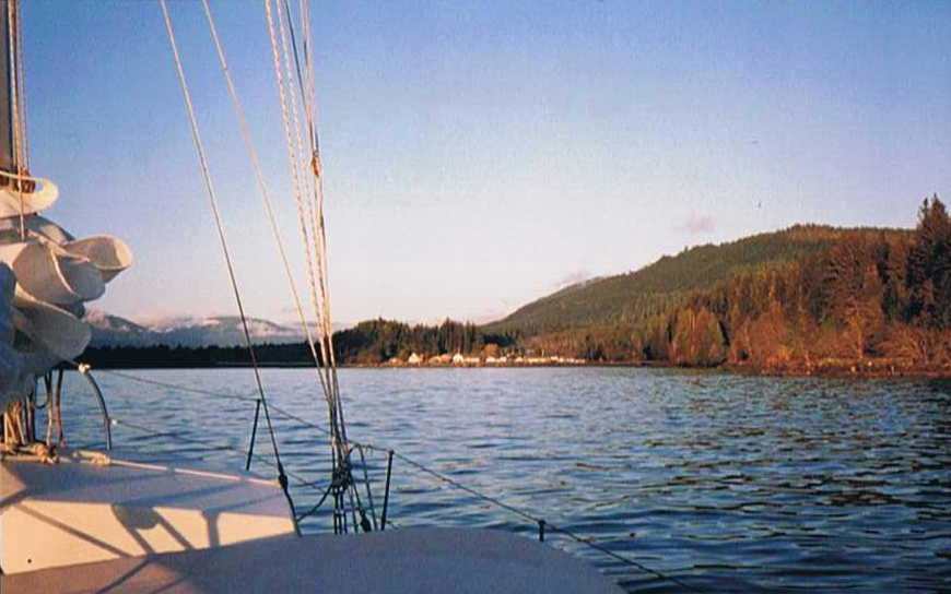
As we neared the north side of Flores Island, thick fog closed in, and visibility was down to what appeared to be one hundred feet. Fortunately, there were no other boats in this area, so we weren't concerned about a collision.
The entrance to Hot Springs Cove appeared through the fog, following our GPS route and we dropped sails and motored up to one of the five empty mooring buoys at 5 P.M. It was quite windy, so John again rigged the storm sail, which worked beautifully. I wanted to go ashore to the springs but John decided we should wait until morning.
Saturday, April 24 - Had a great bath in the hot springs in the early morning. We didn't measure the temperature but it was perfect to soak in, which we did until the our fingers were getting prune-like. The boardwalk was built with great care, and is quite an attraction all by itself. The buoy that we moored to had rubber tire bumpers which left #708090 marks all along the front of Manali's hull, so I held the dinghy while John cleaned her up and we then we anchored away to prevent more marking. I had expected we would head back to Tofino as the winds were perfect for our trip back, but John wanted to spend some time just taking this all in. So, we stayed the rest of the day reading and puttering about on the boat, watching the float planes come and go. Three fishing boats tied up to the float overnight. Sunday, April 25 - I was troubled that my cell phone wasn't picking up any signal and I had told Annamarie I would call her by the end of the week, so at John's suggestion, I rowed the dinghy about a mile to an Indian village nearby and asked about a phone.
A fisherman told me very nicely that there was no phone, but then his wife quietly mentioned that there was one at the store. I got directions to the store, which was nearly a quarter mile up from the dock, in the center of a dozen or so two and three story houses. There are no vehicles in this village, only huge friendly dogs, who immediately began following me around, licking my hands and wagging their tails. The store had no "public" phone and their private phone upstairs was "in use for a long distance call." Although they were otherwise quite friendly, I was pointed to a house and told that they also had a phone. After arriving at the house that had been pointed out, I could see that it was all but boarded up. I very much got the feeling that I was treading on a sore issue. So, not wanting to be an intruder, since it really wasn't an emergency, I decided to forgo the call, and made my way back to the dock. When I reached the dock, the fisherman asked if I got my call through. I lied and told him "yes" and thanked him again. On the way back to Manali, I got caught in a thunder shower and was pretty wet by the time I got back as I hadn't worn my rain gear. Later, we left for "Bottle Neck Cove," only a few miles inland, sailing up Sydney Channel.
Sailing through the narrow entrance, from which it is named, we saw a mink gracefully hopping squirrel like down to the water's edge. When he saw us, he quickly retreated. After anchoring, we could hear a stream running ashore, and John wanted to try out the dinghy for making a water run. He had two large, collapsible water jugs which we filled from the stream. The water was heavy in tannin, so it was yellow and had a foul taste. John thought it was fine so he topped off the main tanks. He then donned his wetsuit and face mask and we rigged a line under the boat so he could go down and inspect the transducer. The depth sounder had been giving false readings and he thought it might have been fouled with growth.

The growth was minimal and the readings stayed the same, so that eliminated one possible cause. We again used the riding sail and had a peaceful night at anchor.
Monday, April 26 - John wanted to try out another anchorage in the area, so we picked West Whitepine Cove, which is much recommended by both Watmough and Douglas in their cruising guides as a well-protected anchorage. John gave in to my concerns and we went via Tofino on the way so I could call Annamarie, although it was some six hours out of our way. On the way back from Tofino, John was shaking the reefs out of the main and discovered that the gooseneck had separated from the boom. There were five large pop rivets that had sheared off, and the mainsail was therefore unusable. Arriving at West Whitepine Cove, we found high winds sweeping the anchorage, and a very steep bottom. This would have required either anchoring with 2:1 scope inside an area accessible only by transiting a two meter deep channel or anchoring in 90+ feet with 300 feet of rode.
John didn't like either choice, and he was also anxious to get the boom fitting fixed, so we returned to Tofino. The repair businesses were closed by the time we arrived, so we tied up opposite the "school boat" pier.
Tuesday, April 27 - John found that there wasn't a rivet gun in town and we couldn't figure out any good way to use bolts. The repair place decided that the town ought to have a rivet gun so they ordered one but it couldn't be delivered until Wednesday. It was fun to see all the local children arrive by water taxi, with their little back packs, on their way to school. Manali's Ontario port of call brought all kinds of comments from the locals and was quite a conversation piece. We talked to several sailboaters who came to chat after seeing the boat.
Wednesday, April 28 - The rivet gun arrived in the afternoon and we had the repair done within minutes, although it was too late in the day to be heading out by the time John had returned the gun. We did take advantage of the local grocery store and showers up the street.
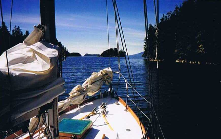
Thursday, April 29 - We motored out Templar Channel and to Barkley Sound, where we rounded Mara Rock again. There we picked up a nice reaching wind up Loudoun Channel to the Pinkerton Islands for our best sail of the trip.
Manali clipped along at 7 knots, seemingly enjoying the sail as much as we were. The anchorage was quite beautiful and the local sea lions and eagles entertained us as they fed on the abundant supply of fish in the water. The gulls also got in on the action. The surface would boil with bait fish until all tummies were full and it was still possible to see the bait fish shimmering on the surface here and there. A most beautiful spot. A pair of locals came by in their aluminum skiff and small outboard to check their crab traps. They slowed down and waved as they passed, seeming embarrassed that they had disturbed our peace.
Friday, April 30 - The weather report predicted gale force winds, but they were supposed to be westerlies so we chanced heading out for Port San Juan. The Strait was calm, so we motored the whole way. Arriving, we found a southerly swell, so we spent a very rolly night. It was not possible to keep from sliding from one side of the quarter berth to the other every so often, so I could only sleep in a braced position.
Saturday, May 1 - We left at 6 A.M. and motor-sailed all the way to Canoe Cove, some 80 miles. We maintained an average speed of nearly 6 knots for the entire trip. John pointed out Bill Garden's famed Toad Island estate on the way back through Iroquois Channel. We moved Corleto to the haul out float and after John cooked me dinner on Manali, we said goodby and I returned to Corleto. I selected and entered waypoints for the return leg and hit the sack early with the alarm set for 5 A.M.
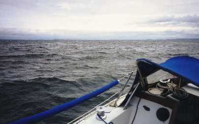
Sunday, May 2 - Corleto and I left at 6 A.M. after I had a breakfast of cereal and fruit while listening to all the weather forecasts. Gale winds were predicted for all the Straits, so I hanked on the storm jib. The main was still reefed from the trip up. I had waypoints for approaching Roche Harbor from Haro Strait, only 10 miles to the east. My plan was to try Haro Strait and retreat to Roche Harbor if necessary. This would be a reach that I could do in high winds if need be. If I hit gales in Juan de Fuca, I could likewise return up Haro Strait with the wind behind me, so I was all set. As it turned out I never had enough wind to sail with the rig I had up. I never knew if it might not quickly come up however, and with an unreliable autopilot, and my leaving my harness on Manali, I didn't want to press my luck with more sail only to have the predicted winds materialize.
Once I cleared the 6 foot waves in Haro Strait and into the smooth waters in the lee of Beaumont Shoal, I went below to use the head. Upon returning to the cockpit I suddenly realized the current was taking us right over the shoal. We got bounced around pretty well in the rough water, but it didn't last long and we were in smooth water again. Half an hour later I spotted breakers ahead, but could see no signs of a buoy. It couldn't be either Salmon Bank or Hein Bank, as they are both marked, so I continued on. As I approached, the water shallowed from 450 foot depths down to 70 feet or so and Corleto began pitching and rolling once again in 2 to 4 foot choppy seas. This lasted for over an hour. Our speed dropped from 6 to 7 knots through the water to 3 or 4 knots, and then the rough water suddenly all disappeared as we hit deep water on the other side. I put her on autopilot and dug out the chart. According to GPS, I had just passed over Middle Bank, which is unmarked. The shallowest water is 66 feet and in most of the bank the depth is near 90 feet. Still, there was a dramatic difference from the deep water.
Looking ahead on the chart, I could see that continuing on a Starboard tack, which I had been planning, would take me right over Hein Bank. But, by changing to a port tack, I would miss it. Similar fixes, and course planning kept me off Eastern, Dallas and Partridge Banks, so I avoided depth-sounder the rough water for the rest of the crossing. By comparing my GPS speed (over the bottom) to my water speed (knot meter) I could see that I hit adverse current as I approached Point Wilson. I had expected favorable current here, but I was caught in a counterclockwise rotation pattern. A cutter appeared ahead of me and passed across my bow. He was running with reefed main and staysail, but moving very fast. He opted for the south side of the channel, while I had expected the more favorable current to be closer to the middle of the channel. He obviously had local knowledge as he easily out ran me even though I was motor-sailing. I had seen this done before with the same results. I guess I'm just a slow learner.
While dropping the sails off Point Hudson, a mega yacht approached me from around Marrowstone Point. I was relieved to see her finally change course and I continued tying the gaskets on the mainsail. I forgot about her wake, however and was nearly thrown overboard when it hit me.
I called Annamarie at 5 pm after clearing customs at Port Townsend. I then moved Corleto to a vacant slip and shaved and cleaned up while Annamarie drove up to meet me. "The Landfall" was closed so we ate at the "El Serape" and had a nice Mexican dinner, my only meal out on the whole trip. Annamarie offered to drive me back up in the morning, so I quickly accepted and returned home for a long hot shower and a good nights sleep.
Monday, May 3 - Annamarie dropped me off at the dock and continued on to her school on Bainbridge. Corleto and I left at noon and hit Port Townsend Canal right at the predicted slack. I knew the canal flood currents began before the Admiralty Inlet slack as I had hit it going the other way before. I shot through with a GPS speed around 9 knots. My GPS speed quickly slowed to 3-4 knots as I proceeded to Point-No-Point. It took me 90 minutes to go the 10 miles as I had managed to get into another rotation, this time clockwise. I was making 9 knots going down the channel but I headed close to shore near the Bodine Road beach cottage area as I had seen a bad slide on the way up.
I wanted to use up the last of my roll of film getting pictures of that and our own slide. I passed the whole area in around 20 feet of water, getting down to 10 feet in a few spots. The nine miles to Kingston took me two hours, instead of the one hour it would have taken if I had stayed outside the back eddies along the shore. That is another thing to chalk up to local knowledge for the future along with those rotations.
So, after about 460 miles, the highlights for me were the Hot Springs, the Pinkerton Islands, and learning more about sailing the Straits, current rotations and back eddies. I have to say that GPS is really a handy tool for trips like these, although I still can't warm up to following routes, waypoint to waypoint. To me, being able to make blind landfalls and learning the various local currents are the real value of GPS.