Kayaking Bowron Lakes Circuit
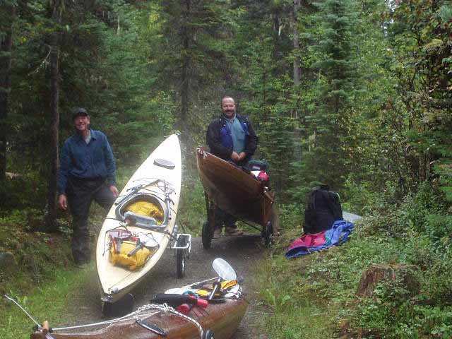
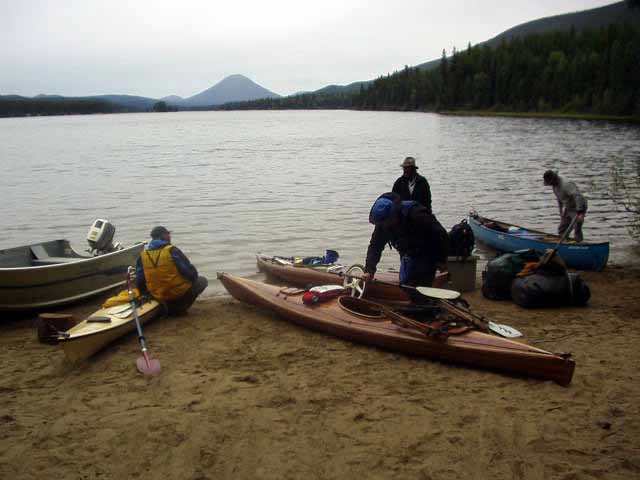
On the pathway of our first portage, we stopped to peel off layers of clothing. We had started with full rain gear, which proved too warm. The Park only allows 60 lbs to be carried in each kayak during the portages, so we had about 25 lbs each additional to carry in our packs. The cart tires chew up the paths if they are overloaded. In these first few portages, we gained about 50 meters in elevation, so the rest of the circuit was more downhill. It was hard to tell on some of them as the paths went up quite high on the hillsides. That's Larry on the left, Stan on the right. Two really great guys.
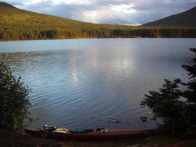
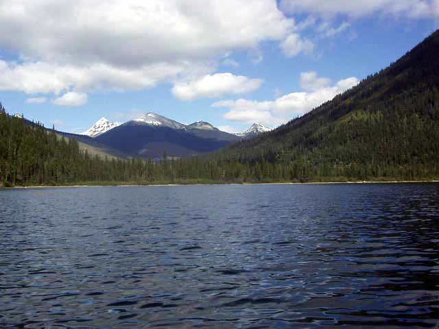
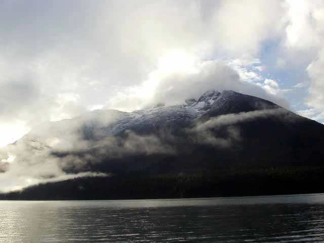
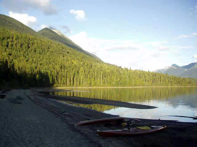
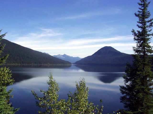
Our first camp was located on Indianpoint Lake. This view is looking west of Indianpoint Mountain at 7pm in the evening. It had rained quite heavily earlier.
The evening sun breaking through at 7:30 pm glowed off Indianpoint mountain to the right with Mount Peever in the background. The temperature got down to 32 F during the night, with a mostly clear sky.
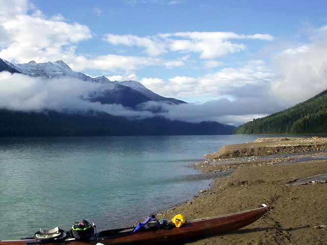
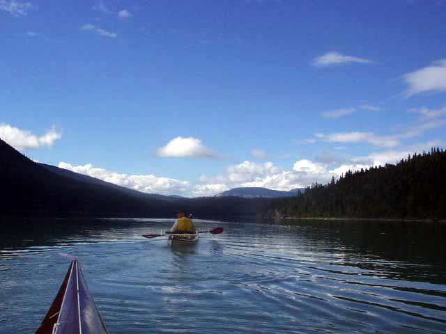
At 9 am the morning fog was burning off and the sun was peeking through. This Vancouver, BC couple were on their first canoe trip. We met many couples on the circuit. We took a more leisurely start than they did.
Looking north at the elbow of Isaac Lake at mid afternoon. We had little wind and nice sunshine this beautiful day, and were able to dry out our tents and gear in the warm sun.
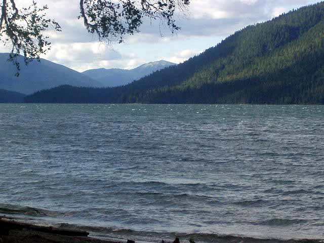
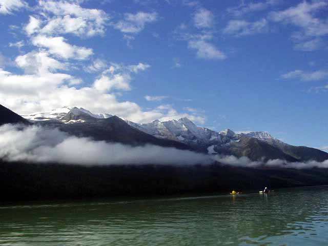
Looking northeast, across Isaac lake, the whitecaps from the midday wind are apparent. We stopped at our camp at noon, and were happy not to be out on the lake.
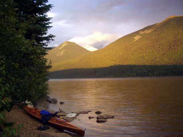
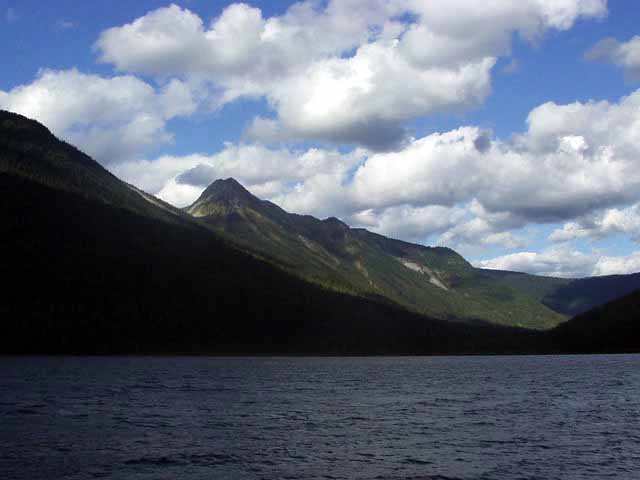
Looking southeast, across Isaac lake, the sun was shining on Mount Amos Bowman, a beautiful sight. We were about midway down the lake across from the Betty Wardle Creek drainage at the group camp on a sandy point. The wind died down completely after sundown and we had a peaceful night.
My digital camera quit the next day with no warning, I suspected the lithium battery had died. I had AA batteries, but they were packed away in the bow. Retrieving them would require a trip to shore and unpacking with no real assurance that this was even the problem. We covered nearly 20 miles this day, the south half of Isaac Lake, portages, and running the Isaac River, which was the highlight of the trip from a paddling sense. I regret not having pictures of it all, but was a very full day, so I had little time for taking pictures.
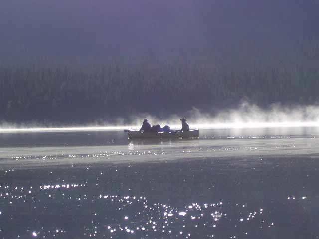
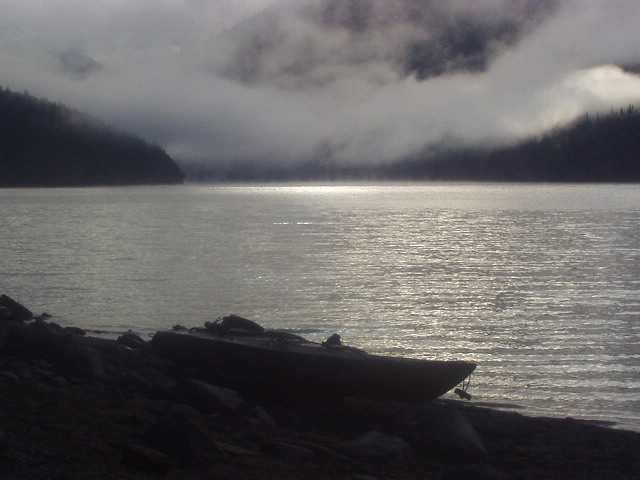
At 8 am on Lanezi Lake at the base of of Needle Point Ridge, waiting for the sun to peek through the fog.
Looking south east across Lanezi Lake in the early morning. A dusting of snow was evident on the higher peaks.
Ishpa Mountain poking through the fog. This was to be a familiar landmark throughout the rest of our trip.
Ishpa Mountain sparkled with a fresh dusting of new snow as the sun poked through. The pictures don't do it justice at all. It was simply breathtaking in it's beauty. We are now in Sandy Lake. The water has quite a milky look to it.
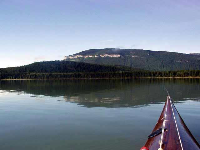
Looking north at Kaza Mountain with it's dusting of overnight snow. It stands at 2499 meters tall, only 31 meters less than Ishpa Mountain. Sandy Lake, from where this picture was taken, is 908 meters above sea level.
Turksnose Mountain to the west came within view. It has a distinctive band of white rock and a "nose", which makes it quite recognizable. It is just west of the park boundary. Looking east at Kaza Mountain from the shore of Sandy Lake. At 6 pm, the shadows already engulf our camp and it is quite cold.
Our ride west toward Cariboo Falls, and the beginning of the only two side trips we made on the circuit.
Turksnose Mountain is quite visible from this point. It acts as guardian over the southern leg, which ends with warning signs for the falls beyond.
This was the final leg.
Our first side trip is to Unna Lake. Access is gained through a narrow slot in the grass. A side view of Ishpa Mountain is presented here, quite hard to miss it from it's distinctive shape and height.
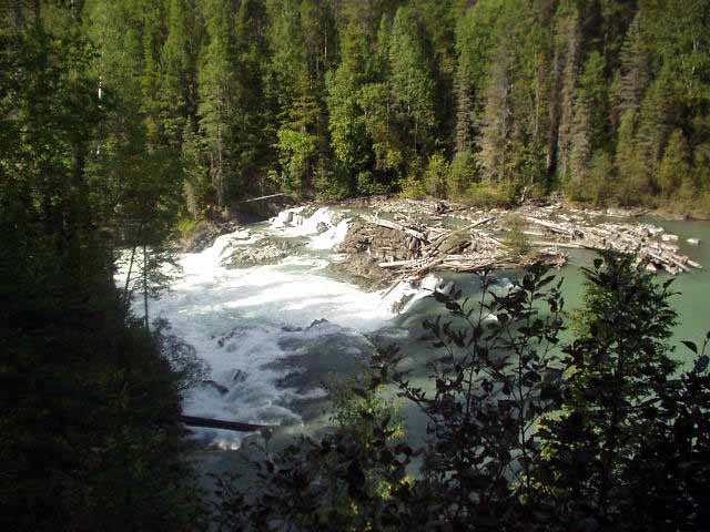
A winding trail up over a pass and alongside a rocky slope reveals the top of Cariboo Falls. This was quite spectacular, as the water thundered over about a 100 foot drop, creating rainbows in the sunlight. It was difficult to see it because of the dense brush on the side of the hill.
This was the end of our last portage. Mike and Larry from Sumner, WA caught up with us and told us of how the World Trade Center and Pentagon had been struck by hijacked commercial planes. They had heard the tale from some workers, who were re-roofing a parks shelter and had a radio. This was 3 pm on Sept. 11. None of us believed it.
Becker's Lodge and the end of our journey lies just on the other side of the cone shaped peak visible above on our north horizon.
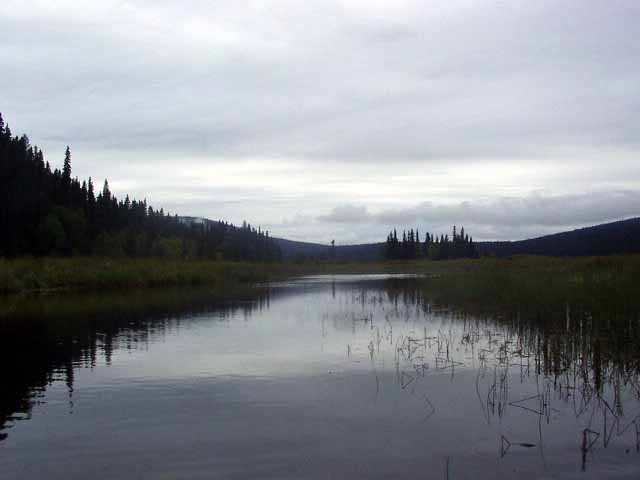
Threading our way along the Bowron River.
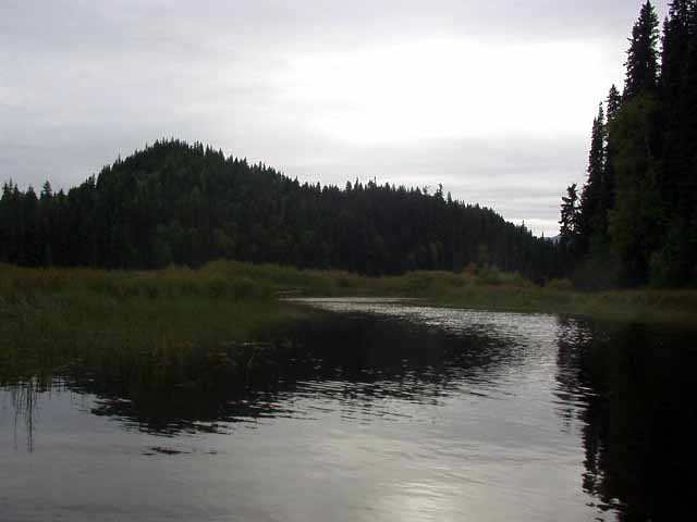
The Bowron River ran on for miles, twisting it's way along through shallow, muddy trails, yet was a mile wide in places, shallow enough for a moose to wade across. We saw many tracks, but no Moose.
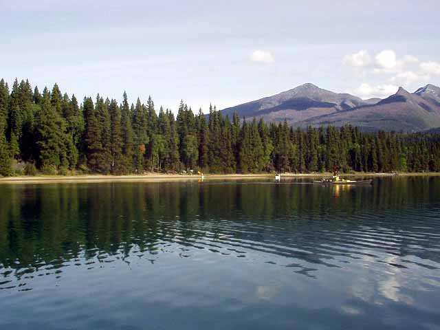
From Becker's Lodge at the northwest corner of the circuit, one gets a nice view of Ishpa Mountain in the far background, reflecting in Bowron lake.
Return to Menu