To Barkley Sound, BC and Return - October 1997
From Kingston, Washington to Ucluelet, B.C. Canada, on the far side of Barkley Sound and back, we logged 390 miles. Barkley Sound lies on the west coast of Vancouver Island, B.C., 35 nautical miles northwest of Tatoosh Island at Cape Flattery, the southern entrance to the Strait of Juan de Fuca.
During the three weeks before we left, I had been monitoring wind speeds at Tatoosh Island using the NOAA web site. On Oct 7th the winds were gusting to 58 knots, we were planning to depart on the 11th and my storm jib had not yet arrived. I was even thinking of calling Bill and canceling the trip. Bill and I had planned this trip some thirty years earlier in Bill's boat and we had been stopped by fog and limited time. Now we were both retired and our float plan had no return date. We were committed, even to the extent of waiting several weeks in port if need be. The weather in this area is centered around low pressure systems which move in from the south and west, bringing strong winds and swells. Entering Barkley Sound requires rounding Cape Beale, which can be quite rough during ebb tides when there is a southerly swell. The ebb tide flow comes all the way from Port Alberni, 40 miles to the north, and when the waters mix with those coming west out the Strait and then hit the swell, tall mixed seas develop. The outer reefs, rocks, and islands of Barkley Sound block the swells, so once inside their effect is much diminished.
Our first obstacle was to cross the Strait. In dense fog without radar, I do not like to chance crossing the commercial traffic lanes in the Straits, so the plan was to cross early and go west along Vancouver Island's southern shore.
Friday, Oct.10 - My storm jib arrived. The trip was on! Despite a 15 knot side wind at my slip, I raised the new offshore main, which had arrived earlier in the week and fit out the reefing lines. The boat was heeling 20 degrees or more at the slip while I drilled and tapped holes in the boom to accept the new hardware. I finished early, and couldn't resist taking the new sails out for a trial run. "Corleto", my Catalina 27, loved her new sails, and pointed beautifully, making 6.5 knots and not even slowing down for the waves.
Saturday, Oct.11 - Left Kingston at 12:30 PM after provisioning and awaiting a favorable tide. We motor sailed with the working jib and main as there was a slight easterly breeze, but not enough to sail on. Just off Foulweather Bluff we were suddenly hit with a northwest wind of 20 knots so we cut the engine and hung on for the ride. This quite often happens in this area as the winds wrap around the Olympic mountains, where the wind will reverse itself with no warning, and with great strength. As the wind grew, I decided to reef the new main, which reduced our heel, but we were still making 6 to 7 knots even though the wind waves were 3 feet at times, steepened by the effect of the wind and tide being in different directions. We cleared Bush Point on a port tack and got abreast of Marrowstone Point before our first tack, which pointed us directly to Hudson Point. Arriving in Port Townsend at 7:30, after dodging the incoming ferry, we found various sized logs also to dodge in the water, but the lights from the town helped and the wind died down by then, so they were easy to see.
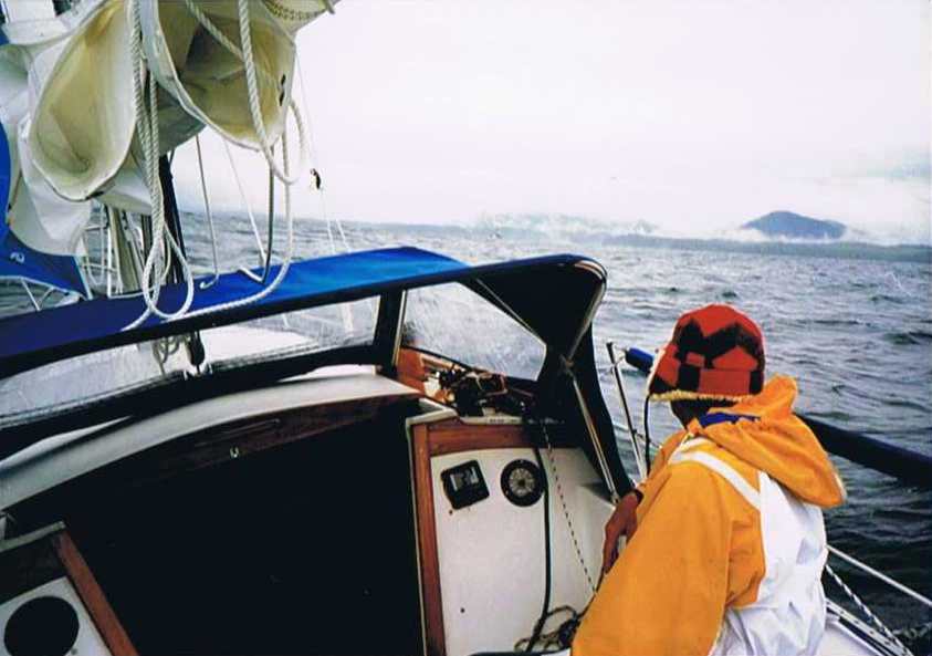
Sunday, Oct.12 - Left Port Townsend at 11:30 in slight rain across the Strait, with visibility about 2 miles and a nice following wind. I left the reef in the main and put up the storm jib as we had no idea what the Strait might have in store for us. Once we cleared the confused waters off Point Wilson, the reefed main pushed us along at near hull speed, with the jib mostly in the wash. Bill spotted an American White Pelican. Unheard of this far north.
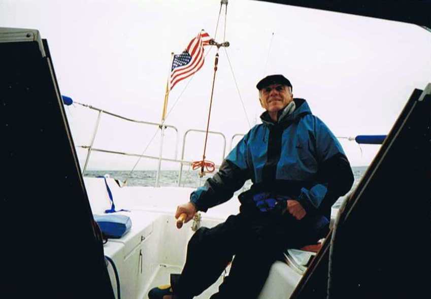
Bill at the helm crossing the Strait
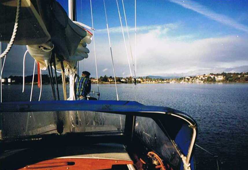
We arrived in Victoria at 8:30 pm, again dodging logs in the water. The autopilot worked well on this leg. I managed to get into a large kelp bed in 5 fathoms just outside the harbor, and if we hadn't had a folding propeller I'm not sure we could have passed through. There were only two other sail boats in the whole harbor and no one was sailing. I checked into customs via phone. The agent had Corleto in his file and asked if I knew the prior owner. I was impressed.
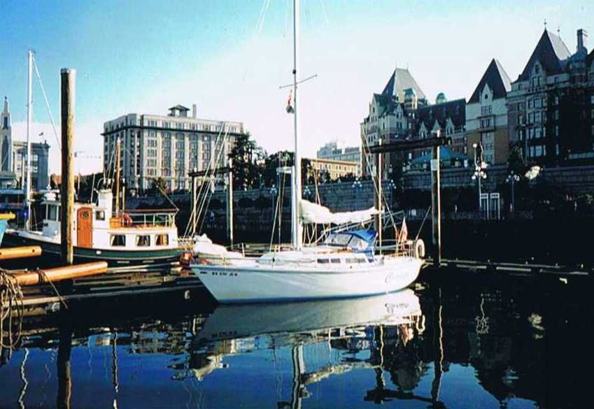
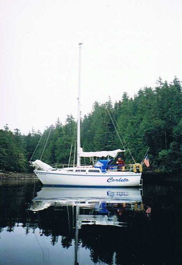
Corleto in Victoria Harbour
Monday, Oct 13 - Departed at 9:30 AM after good warm breakfast and rounded Race Rocks at 12:30, still on flood tide. Hundreds of sea lions serenaded us as we passed, and Cormorants scented the air.
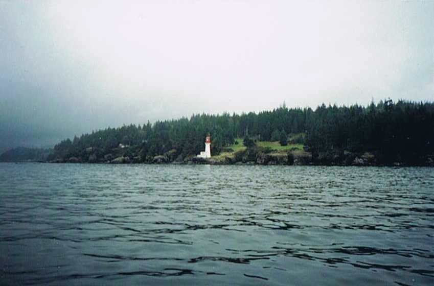
Lighthouse at Sherringham Point
The breeze dropped too low to continue on the drifter, so had to motor all the way to Port Renfrew. The light is obscured coming in, and if it weren't for seeing the swells breaking on the rocks, we might have run right in to them. A very bad entrance from the east in the dark. Once inside at 9 PM, we found ourselves in the midst of several hundred commercial fishing boats, most anchored, many just motoring around in no particular pattern awaiting their turn with the buyers. The only sheltered spot we could find was at the far north east end of the bay in 2.5 fathoms so we "dropped the hook" and since we had already eaten underway, we hit the sack and set the alarm for an early departure.
Tuesday, Oct. 14 - I awoke early to what I thought was the sound of strong winds but upon inspection in daylight, discovered it was the swell breaking on rocks only 50 yards beyond where we were anchored, now in 1.6 fathoms. All but a dozen or so of the fishing boats were gone, so we weighed anchor and headed out at 7:30 AM.
We passed the only other sailboat we encountered until Smith Island on the way back. He came along side and asked if we "needed help". A good easterly was blowing and the drifter sped us along at 6 to 7 knots.
During the three weeks before we left, I had been monitoring wind speeds at Tatoosh Island using the NOAA web site. On Oct 7th the winds were gusting to 58 knots, we were planning to depart on the 11th and my storm jib had not yet arrived. I was even thinking of calling Bill and canceling the trip. Bill and I had planned this trip some thirty years earlier in Bill's boat and we had been stopped by fog and limited time. Now we were both retired and our float plan had no return date. We were committed, even to the extent of waiting several weeks in port if need be. The weather in this area is centered around low pressure systems which move in from the south and west, bringing strong winds and swells. Entering Barkley Sound requires rounding Cape Beale, which can be quite rough during ebb tides when there is a southerly swell. The ebb tide flow comes all the way from Port Alberni, 40 miles to the north, and when the waters mix with those coming west out the Strait and then hit the swell, tall mixed seas develop. The outer reefs, rocks, and islands of Barkley Sound block the swells, so once inside their effect is much diminished.
Our first obstacle was to cross the Strait. In dense fog without radar, I do not like to chance crossing the commercial traffic lanes in the Straits, so the plan was to cross early and go west along Vancouver Island's southern shore.
Friday, Oct.10 - My storm jib arrived. The trip was on! Despite a 15 knot side wind at my slip, I raised the new offshore main, which had arrived earlier in the week and fit out the reefing lines. The boat was heeling 20 degrees or more at the slip while I drilled and tapped holes in the boom to accept the new hardware. I finished early, and couldn't resist taking the new sails out for a trial run. "Corleto", my Catalina 27, loved her new sails, and pointed beautifully, making 6.5 knots and not even slowing down for the waves.
Saturday, Oct.11 - Left Kingston at 12:30 PM after provisioning and awaiting a favorable tide. We motor sailed with the working jib and main as there was a slight easterly breeze, but not enough to sail on. Just off Foulweather Bluff we were suddenly hit with a northwest wind of 20 knots so we cut the engine and hung on for the ride. This quite often happens in this area as the winds wrap around the Olympic mountains, where the wind will reverse itself with no warning, and with great strength. As the wind grew, I decided to reef the new main, which reduced our heel, but we were still making 6 to 7 knots even though the wind waves were 3 feet at times, steepened by the effect of the wind and tide being in different directions. We cleared Bush Point on a port tack and got abreast of Marrowstone Point before our first tack, which pointed us directly to Hudson Point. Arriving in Port Townsend at 7:30, after dodging the incoming ferry, we found various sized logs also to dodge in the water, but the lights from the town helped and the wind died down by then, so they were easy to see.
Sunday, Oct.12 - Left Port Townsend at 11:30 in slight rain across the Strait, with visibility about 2 miles and a nice following wind. I left the reef in the main and put up the storm jib as we had no idea what the Strait might have in store for us. Once we cleared the confused waters off Point Wilson, the reefed main pushed us along at near hull speed, with the jib mostly in the wash. Bill spotted an American White Pelican. Unheard of this far north.
We arrived in Victoria at 8:30 pm, again dodging logs in the water. The autopilot worked well on this leg. I managed to get into a large kelp bed in 5 fathoms just outside the harbor, and if we hadn't had a folding propeller I'm not sure we could have passed through. There were only two other sail boats in the whole harbor and no one was sailing. I checked into customs via phone. The agent had Corleto in his file and asked if I knew the prior owner. I was impressed.
Monday, Oct 13 - Departed at 9:30 AM after good warm breakfast and rounded Race Rocks at 12:30, still on flood tide. Hundreds of sea lions serenaded us as we passed, and Cormorants scented the air.
The breeze dropped too low to continue on the drifter, so had to motor all the way to Port Renfrew. The light is obscured coming in, and if it weren't for seeing the swells breaking on the rocks, we might have run right in to them. A very bad entrance from the east in the dark. Once inside at 9 PM, we found ourselves in the midst of several hundred commercial fishing boats, most anchored, many just motoring around in no particular pattern awaiting their turn with the buyers. The only sheltered spot we could find was at the far north east end of the bay in 2.5 fathoms so we "dropped the hook" and since we had already eaten underway, we hit the sack and set the alarm for an early departure.
Tuesday, Oct. 14 - I awoke early to what I thought was the sound of strong winds but upon inspection in daylight, discovered it was the swell breaking on rocks only 50 yards beyond where we were anchored, now in 1.6 fathoms. All but a dozen or so of the fishing boats were gone, so we weighed anchor and headed out at 7:30 AM.
We passed the only other sailboat we encountered until Smith Island on the way back. He came along side and asked if we "needed help". A good easterly was blowing and the drifter sped us along at 6 to 7 knots.
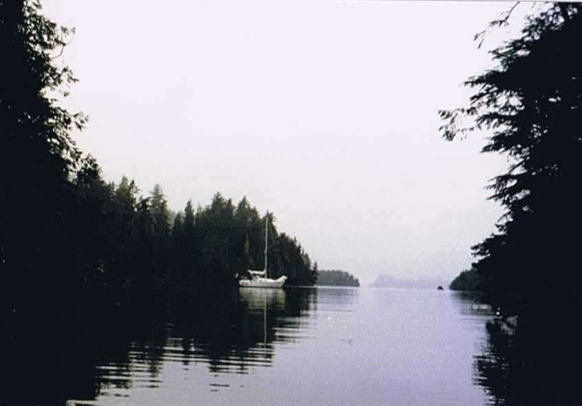
We arrived at Cape Beale during the last of the ebb, which was running into a 12 foot swell and caused waves to stack up to 20 feet high with near vertical sides at times, and in not any predictable pattern.
Approaching Cape Beale
Bill said he had not experienced seas this large, even in the Queen Charlottes in bad weather. Visibility was reduced to about a mile but we found our way to Bamfield before dark.
Approaching Bamfield
We had arrived! Both these runs were about 51 miles, so making this one in less than 10 hours was most satisfying.
Wednesday, Oct. 15 - The townspeople and fishermen were all quite friendly as we were the only "tourists" in town, and it would have been easy to have spent a whole day just talking and listening to everyone.
Bill said he had not experienced seas this large, even in the Queen Charlottes in bad weather. Visibility was reduced to about a mile but we found our way to Bamfield before dark.
We had arrived! Both these runs were about 51 miles, so making this one in less than 10 hours was most satisfying.
Wednesday, Oct. 15 - The townspeople and fishermen were all quite friendly as we were the only "tourists" in town, and it would have been easy to have spent a whole day just talking and listening to everyone.
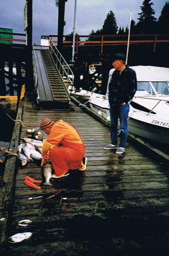
One gill netter was cleaning his night's catch of chum salmon on the dock. His wife later arrived by pickup and they iced the fish down for her return trip to Naniamo, where they were fetching $1 a pound instead of 60 cents locally. Another pair of gill netters were repairing their nets. After a good breakfast and a long hot shower, we motored across Trevor Channel through Satellite Passage, across Imperial Eagle Channel and into Effingham Island's north cove where we anchored in 10 meters.
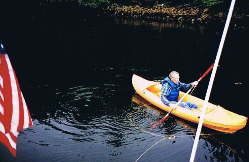
We inflated the kayak and had our first try in it separately, paddling around the cove. The fresh water from the island came from bogs and lay on top of the saltwater and was a brownish yellow color, giving the appearance that the water was that color all the way down.
We inflated the kayak and had our first try in it separately, paddling around the cove. The fresh water from the island came from bogs and lay on top of the saltwater and was a brownish yellow color, giving the appearance that the water was that color all the way down.
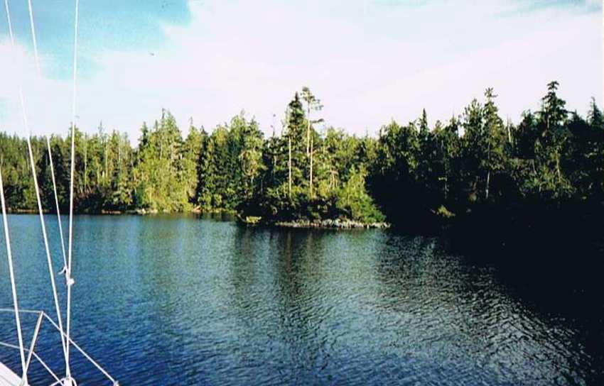
The salt water in Barkley Sound is so clear that we could easily see the anchor on the bottom in daylight. Globs of foam were in the cove, having floated out from several streams on the Island. The tide was low and barnacles covered the rocks so there was no suitable landing place where the trail took off, so we waited for high tide. The full moon poked through the clouds and the old growth spruce trees were silhouetted against the sky, making us feel back in time to when Captain Barkley moored there when it must have looked just the same.
Thursday, Oct. 16 - On the morning's high tide, Bill and I both got into the kayak and were able to beach it on a grassy area, up the stream where the trail took off. We pulled the kayak up several more feet and tied her off to a tree that stuck out from the shore. The trail was easy to follow as the summer visitors had worn it down quite well.
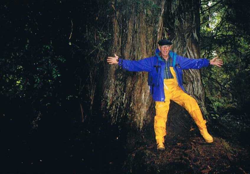
Old growth cedar tree
Spruce and cedar trees of immense size grow near the trail, some 10 feet or more in diameter. Not a single stump was to be found anywhere in this area. We crossed the island to the remains of the Indian village on the north eastern shore. The midden pile is indeed 30 feet high and several hundred feet long.
South side of Effingham Island
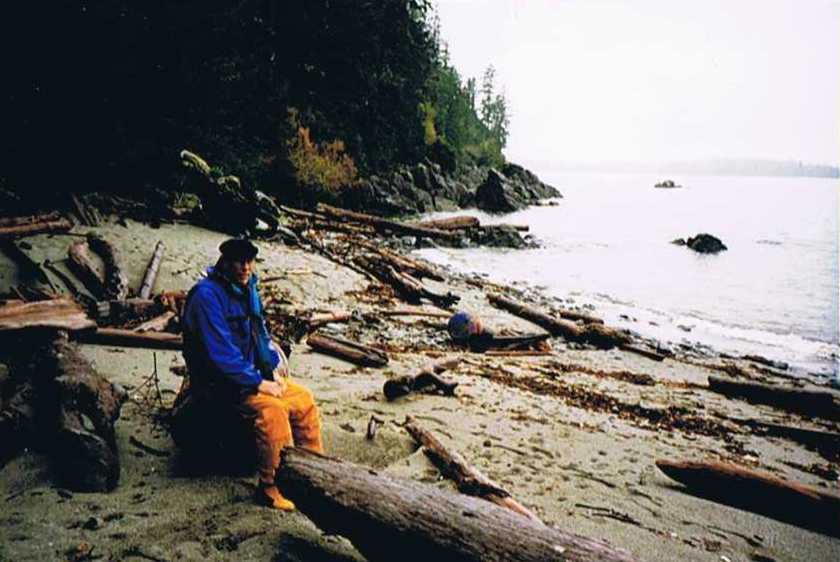
A nice sandy beach. There are sea caves to the south along the beach, but the tide was too high to get there. Upon return to our side of the Island, the tide had come in more than expected and I had to wade over my boot tops to retrieve the line to the kayak. The setting was so pleasant and the fog outside looked so formidable, we stayed a second night.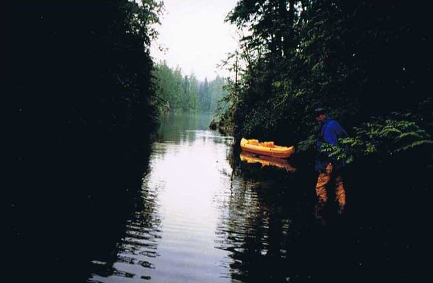
Over my boot tops
Friday, Oct. 17 - After careful study of Bill's several charts, I decided on the safest course to Ucluelet.
The fog lifted
We passed between Clark and Benson Islands, then between Alley and Great Bear rocks, around Crow Island and up to Ucluelet Inlet. A strong northwest wind came up, but it was right on our nose. We managed to dock Corleto only after three passed at the dock and I regained my senses that I was the skipper and Bill was expecting me to give some meaningful directions.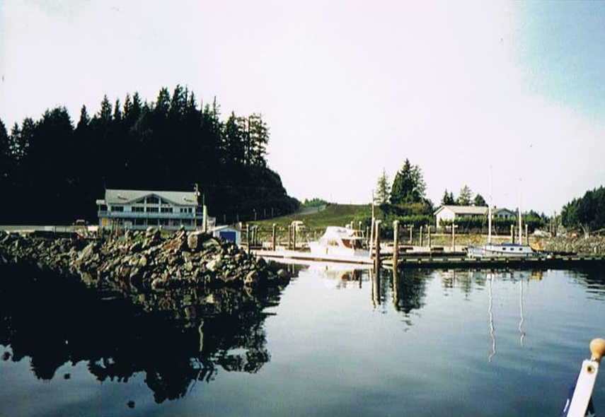
Arriving in Ucluelet
The dock had no cleats and the wind was blowing us away from the only part that was deep enough for our craft, so it was a little hairy. At low tide, we were reading 1.4 meters on the fathometer. Corleto draws 1.2 meters. Ucluelet is a great town in the off season and the local folks were all quite helpful and friendly and we were treated with great respect.
Saturday, Oct. 18 - Breakfast at Matterton Cafe was so superb Bill wants to return by car to have dinner there with his wife. We left leisurely and motored over to Jaques Island. This was the most scenic part of the trip. It's easy to see why they are called "The Broken Group", as there are hundreds of rocks, Islands and Islets. Most looking exactly the same.
The Broken Group, Barkley Sound
I mistook the rock off Mullins Island for the one off Kieth Island and we ended up in the middle of a bunch of submerged rocks before realizing my mistake. Luckily, the water was clear and we didn't hit any. We went inside the inner cove on the south side of the isthmus, which shallowed to three feet later. We lifted the anchor and drifted out while we still had a few feet under the keel. First we went ashore in the kayak to visit the lagoon on the north side. Gobs of moss several feet thick hung on old growth trees and the local eagle and sea lion came to check us out. The night sky, before the moon rose, was fantastic. The air was clear and being away from any lights, the milky way stood out clear and bold and the stars were so bright you could recognize the patterns even from the reflections in the water. We deflated the kayak and stowed it for the journey home. We saw no other pleasure boats in the entire area of Barkley Sound, only a couple of commercial fishing boats, and a few small outboard skiffs with apparently local fishermen near the harbors.
Sunday, Oct. 19 - 7:45 AM. Motored out Harbor Channel to Imperial Channel and set the drifter, which pulled us at 6+ knots past Folger Island and then past Cape Beale. Bill spotted two more pelicans. The wind was an easterly, right on our nose, and the drifter was not allowing us to point well so switched to the working jib. The port tack was closer to Neah Bay than the starboard tack so stayed on it until about 5 PM, at which point, we were a mile or so south of Tatoosh Island, and a couple of miles west. In the Pacific Ocean! Our starboard tack took us on a near perfect course but the wind died within minutes after sundown at 6:14, and we had to motor the rest of the way. The sun was blood red sitting on the horizon, a sight not often seen by Puget Sounders.
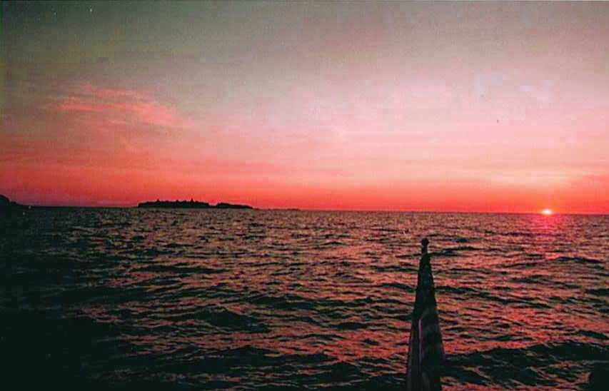
"Red Sky at Night, Sailor's Delight"
We had discovered Duncan Rock dead ahead from the swells breaking, which were visible for a good mile. Arrived in Neah Bay at 8 PM and found a pizza place that also had good brownies. Excellent pier facilities.
Monday, Oct. 20 - Left at 7:45 AM after phoning in to customs and headed east for Port Angeles. Wind waves from the east stacked up against the flood current to produce pitching in Corleto that held our speed to 3 knots motoring. I rigged up a pigtail to raise the tack of the working jib and sheeted it in to the inside track and we motor-sailed. I used to scoff at motor-sailors, but I've found that Corleto does well in these conditions, and we had over 50 miles to go with less than 10 hours daylight and too many logs in the water. At about 3/4 across the strait nearing River Jordan, the waves were coming nearly head on and we were loosing speed so we tacked back to Pillar Point, where we tacked once again. The wind picked up and we were able to make 6 knots on sail alone. With the jib sheeted inside it took full concentration on the tiller to keep the speed up. By sundown, we were 12 miles off Race Rocks and the wind again nearly died, but the waves were less, so we continued with the motor. We hit a fairly strong ebb tide rounding the rocks and it took us until 11:35 PM to get tied up back at the Empress in Victoria. We encountered the worst amount of flotsam in the water that either of us had ever seen so we had spent the last 5 hours both on our feet straining to spot logs and clumps of kelp, bundled by the storm two weeks prior. It was a long day.
Tuesday, Oct. 21 - We slept in late and decided to make it a lay day. Enjoyed shopping around Victoria and had a few more good meals and too much dessert.
Wednesday, Oct. 22 - Left at 8 AM into the lumpiest water either of us could remember. At one point, I had to turn 90 degrees off course to avoid a tangle of crab floats and line that spread out over 100 feet wide. We saw telephone pole size logs all around. About 1/3 across, the water smoothed out silky smooth and we saw an orca whale, apparently all by himself. Motored into Port Townsend at 4:45 and Bill bought me dinner at the Belmont.
Thursday, Oct. 23 - Left at 7:30 and arrived Kingston less than five hours later via the Port Townsend Canal. While coming into the harbor, and dodging a gill netters net I had to head straight toward the sun and managed to run into a large log with the bow. It missed the propeller and didn't appear to break anything, but it sure gave us a jolt.
So, we were lucky. Less than a week later the wind was 45 knots in the Strait and there has been a lot of fog intermixed with strong winds. Doing the trip again, I might put in at Sooke Harbour. It's still too long a run from there to Bamfield in October, so the best route might be Port Townsend, Port Angeles, Sekiu, Neah Bay and then Bamfield. Sekiu could be skipped on favorable tide conditions. We found Port Renfrew okay, but we were told by fishermen in Bamfield that it can be a trap if a southerly comes up as the swell builds up so you can't get out and can't anchor either. The only hope is to make a break for Neah Bay, 10 miles into the wind.
I spent several hours studying the October tide tables, and discovered that the daylight hours in October favor ebb currents by four to one when one figures in the velocity as well as the time. The cycles of the moon vary it a little, but there is no perfect time to hit the tides coming back except in the dark. So, shorter runs need to be planned for unless a strong westerly is encountered where one might average over 6 knots like we did on the way out. I have since noticed that the easterlies we encountered in the Straits are not usual this time of year.
Spruce and cedar trees of immense size grow near the trail, some 10 feet or more in diameter. Not a single stump was to be found anywhere in this area. We crossed the island to the remains of the Indian village on the north eastern shore. The midden pile is indeed 30 feet high and several hundred feet long.
A nice sandy beach. There are sea caves to the south along the beach, but the tide was too high to get there. Upon return to our side of the Island, the tide had come in more than expected and I had to wade over my boot tops to retrieve the line to the kayak. The setting was so pleasant and the fog outside looked so formidable, we stayed a second night.
Friday, Oct. 17 - After careful study of Bill's several charts, I decided on the safest course to Ucluelet.
We passed between Clark and Benson Islands, then between Alley and Great Bear rocks, around Crow Island and up to Ucluelet Inlet. A strong northwest wind came up, but it was right on our nose. We managed to dock Corleto only after three passed at the dock and I regained my senses that I was the skipper and Bill was expecting me to give some meaningful directions.
The dock had no cleats and the wind was blowing us away from the only part that was deep enough for our craft, so it was a little hairy. At low tide, we were reading 1.4 meters on the fathometer. Corleto draws 1.2 meters. Ucluelet is a great town in the off season and the local folks were all quite helpful and friendly and we were treated with great respect.
Saturday, Oct. 18 - Breakfast at Matterton Cafe was so superb Bill wants to return by car to have dinner there with his wife. We left leisurely and motored over to Jaques Island. This was the most scenic part of the trip. It's easy to see why they are called "The Broken Group", as there are hundreds of rocks, Islands and Islets. Most looking exactly the same.
I mistook the rock off Mullins Island for the one off Kieth Island and we ended up in the middle of a bunch of submerged rocks before realizing my mistake. Luckily, the water was clear and we didn't hit any. We went inside the inner cove on the south side of the isthmus, which shallowed to three feet later. We lifted the anchor and drifted out while we still had a few feet under the keel. First we went ashore in the kayak to visit the lagoon on the north side. Gobs of moss several feet thick hung on old growth trees and the local eagle and sea lion came to check us out. The night sky, before the moon rose, was fantastic. The air was clear and being away from any lights, the milky way stood out clear and bold and the stars were so bright you could recognize the patterns even from the reflections in the water. We deflated the kayak and stowed it for the journey home. We saw no other pleasure boats in the entire area of Barkley Sound, only a couple of commercial fishing boats, and a few small outboard skiffs with apparently local fishermen near the harbors.
Sunday, Oct. 19 - 7:45 AM. Motored out Harbor Channel to Imperial Channel and set the drifter, which pulled us at 6+ knots past Folger Island and then past Cape Beale. Bill spotted two more pelicans. The wind was an easterly, right on our nose, and the drifter was not allowing us to point well so switched to the working jib. The port tack was closer to Neah Bay than the starboard tack so stayed on it until about 5 PM, at which point, we were a mile or so south of Tatoosh Island, and a couple of miles west. In the Pacific Ocean! Our starboard tack took us on a near perfect course but the wind died within minutes after sundown at 6:14, and we had to motor the rest of the way. The sun was blood red sitting on the horizon, a sight not often seen by Puget Sounders.
We had discovered Duncan Rock dead ahead from the swells breaking, which were visible for a good mile. Arrived in Neah Bay at 8 PM and found a pizza place that also had good brownies. Excellent pier facilities.
Monday, Oct. 20 - Left at 7:45 AM after phoning in to customs and headed east for Port Angeles. Wind waves from the east stacked up against the flood current to produce pitching in Corleto that held our speed to 3 knots motoring. I rigged up a pigtail to raise the tack of the working jib and sheeted it in to the inside track and we motor-sailed. I used to scoff at motor-sailors, but I've found that Corleto does well in these conditions, and we had over 50 miles to go with less than 10 hours daylight and too many logs in the water. At about 3/4 across the strait nearing River Jordan, the waves were coming nearly head on and we were loosing speed so we tacked back to Pillar Point, where we tacked once again. The wind picked up and we were able to make 6 knots on sail alone. With the jib sheeted inside it took full concentration on the tiller to keep the speed up. By sundown, we were 12 miles off Race Rocks and the wind again nearly died, but the waves were less, so we continued with the motor. We hit a fairly strong ebb tide rounding the rocks and it took us until 11:35 PM to get tied up back at the Empress in Victoria. We encountered the worst amount of flotsam in the water that either of us had ever seen so we had spent the last 5 hours both on our feet straining to spot logs and clumps of kelp, bundled by the storm two weeks prior. It was a long day.
Tuesday, Oct. 21 - We slept in late and decided to make it a lay day. Enjoyed shopping around Victoria and had a few more good meals and too much dessert.
Wednesday, Oct. 22 - Left at 8 AM into the lumpiest water either of us could remember. At one point, I had to turn 90 degrees off course to avoid a tangle of crab floats and line that spread out over 100 feet wide. We saw telephone pole size logs all around. About 1/3 across, the water smoothed out silky smooth and we saw an orca whale, apparently all by himself. Motored into Port Townsend at 4:45 and Bill bought me dinner at the Belmont.
Thursday, Oct. 23 - Left at 7:30 and arrived Kingston less than five hours later via the Port Townsend Canal. While coming into the harbor, and dodging a gill netters net I had to head straight toward the sun and managed to run into a large log with the bow. It missed the propeller and didn't appear to break anything, but it sure gave us a jolt.
So, we were lucky. Less than a week later the wind was 45 knots in the Strait and there has been a lot of fog intermixed with strong winds. Doing the trip again, I might put in at Sooke Harbour. It's still too long a run from there to Bamfield in October, so the best route might be Port Townsend, Port Angeles, Sekiu, Neah Bay and then Bamfield. Sekiu could be skipped on favorable tide conditions. We found Port Renfrew okay, but we were told by fishermen in Bamfield that it can be a trap if a southerly comes up as the swell builds up so you can't get out and can't anchor either. The only hope is to make a break for Neah Bay, 10 miles into the wind.
I spent several hours studying the October tide tables, and discovered that the daylight hours in October favor ebb currents by four to one when one figures in the velocity as well as the time. The cycles of the moon vary it a little, but there is no perfect time to hit the tides coming back except in the dark. So, shorter runs need to be planned for unless a strong westerly is encountered where one might average over 6 knots like we did on the way out. I have since noticed that the easterlies we encountered in the Straits are not usual this time of year.
Return to Boating Trips